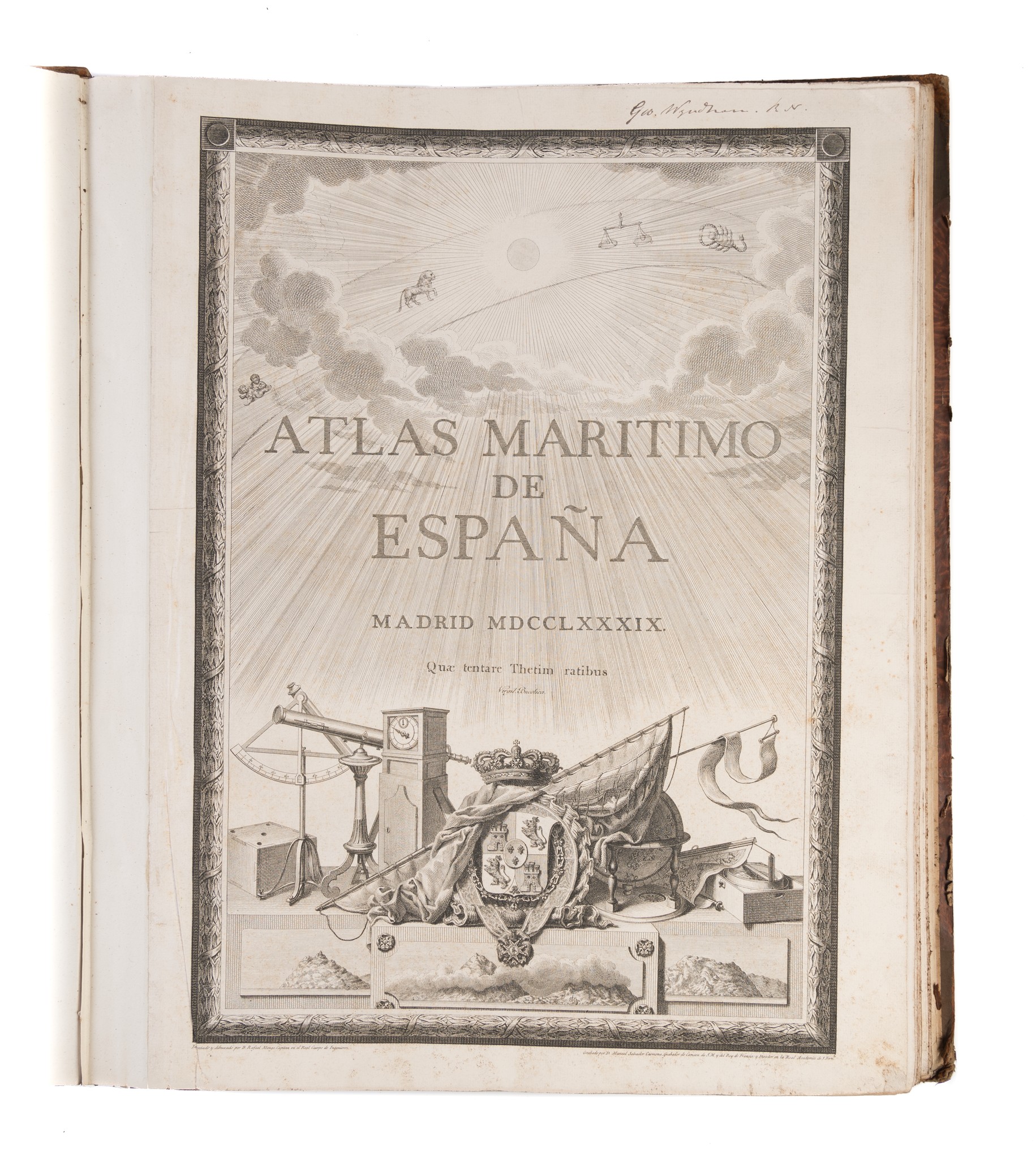
Atlas Maritimo de España.
TOFINO DE SAN MIGUEL Vicente. (1789)
£13500.00
Please contact us in advance if you would like to view this book at our Curzon Street shop.
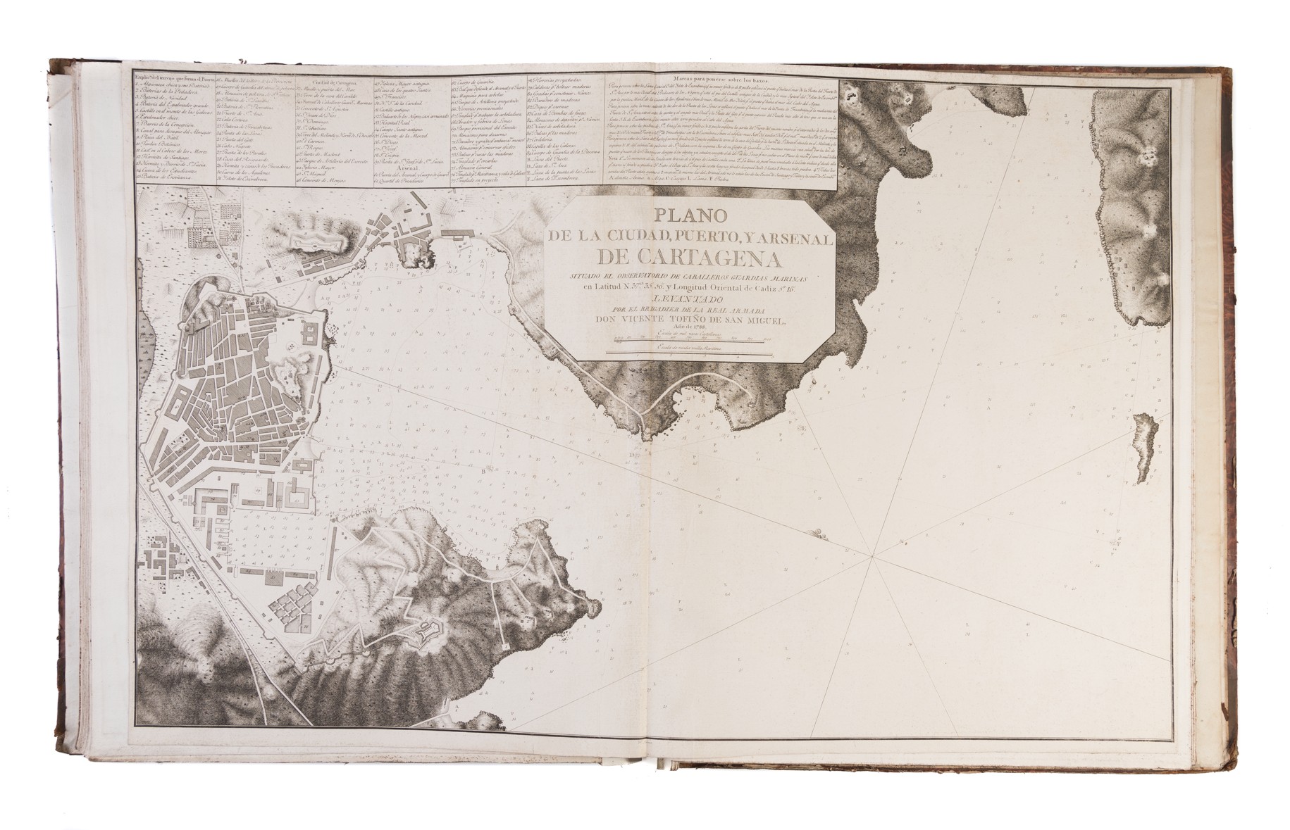
Elephant folio (615 x 500 mm); engraved title-page; forty-nine sheets, the manuscript index on the front paste-down, compiled by the British owner, calling for forty-eight, comprising twenty-six double-page charts, six double-page and seven single-page harbour charts, nine double-page and one single-page sheets of coastal profiles, with an additional chart of the Straits of Gibraltar loosely inserted. Original boards. Madrid : Vicente Tofiño De San Miguel,
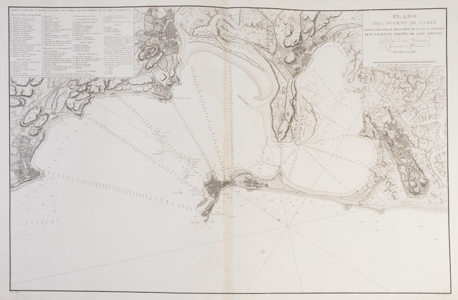
Despite its long maritime heritage, Spain (and Portugal) lagged behind the rest of Europe in terms of chart publishing. Vicente Tofiño De San Miguel (1732-1795) was a Spanish mariner and chart-maker, who published the first printed Spanish sea-atlas, the Atlas maritimo de Espana, 1787 [-1789]. This volume is one part of the Atlas maritimo de Espana', containing only those charts of the Atlantic coasts of Spain and north-western Africa, with a series of charts of the major harbours, including Vigo Bay, Bilbao and Cadiz.
This was the most important sea-atlas of Spanish coastal waters and facing coast of Africa of the period, rendered particularly important by the naval operations during the war between Britain and Spain. This a very good example of the atlas, with the charts and plates in good dark impressions.
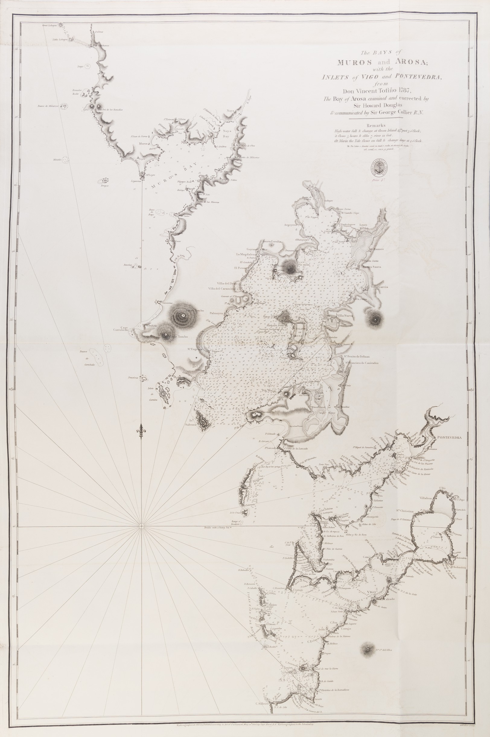
A British owner has inserted two English Admiralty charts, 'Bays of Muros and Arosa; with the inlets of Vigo and Pontevedra ...', engraved by Michael Walker, 1813 (number 4) and William Henry "Mediterranean" Smyth's 'Chart of the Strait of Gibraltar ..., 1826, loosely inserted.
Stock Code: 223007


