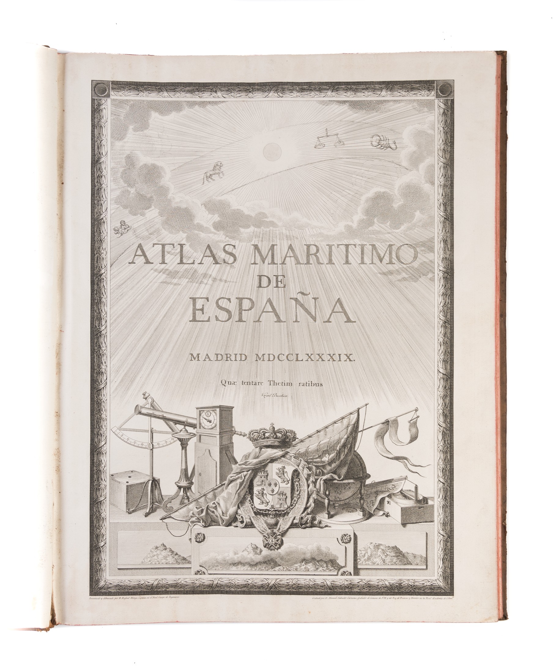
Atlas maritimo de España [Volume 1: the Atlantic coasts]
TOFINO DE SAN MIGUEL Vicente (1789)
£9000.00
Please contact us in advance if you would like to view this book at our Curzon Street shop.
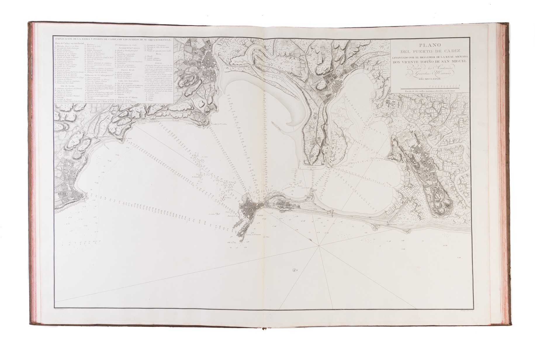
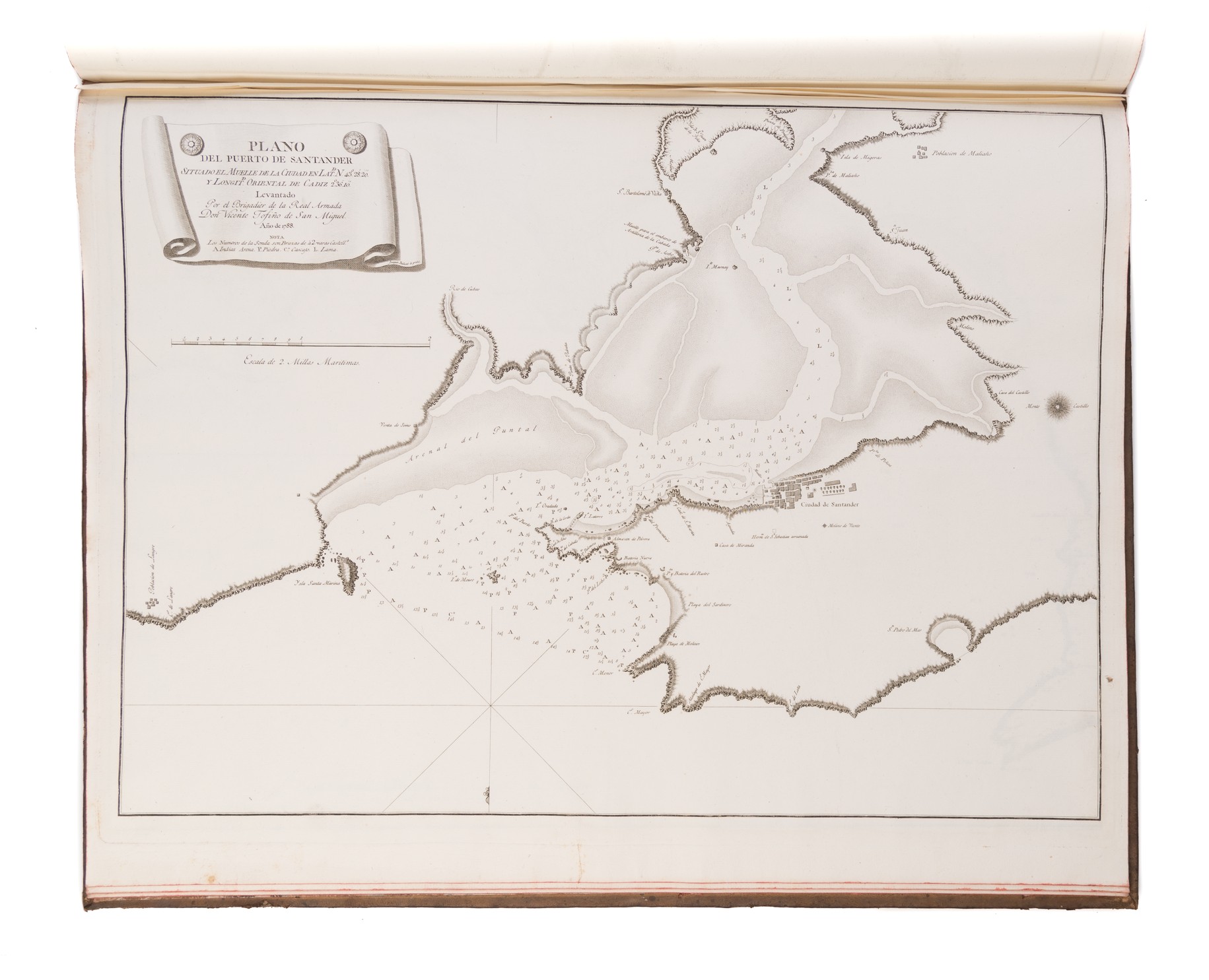
Elephant folio (622 x 480 mm); engraved title-page; thirty-one sheets, comprising fourteen double-page charts, four double-page and seven single-page harbour charts, five double-page and one single-page sheets of coastal profiles. Original boards, marbled end-papers. Book-plate of Robert Henry Clive. Madrid : Vicente Tofiño De San Miguel,
Despite its long maritime heritage, Spain (and Portugal) lagged behind the rest of Europe in terms of chart publishing.
Don Tofiño De San Miguel (1732-1795) was a Spanish mariner and chart-maker, who published the first printed Spanish sea-atlas, the Atlas maritimo de Espana, 1787 [-1789]. This volume is one part of the Atlas maritimo de Espana, containing only those charts of the Atlantic coasts of Spain and north-western Africa, with a series of charts of the major harbours, including Vigo Bay, Bilbao and Cadiz.
This was the most important sea-atlas of Spanish coastal waters and facing coast of Africa of the period, rendered particularly important by the naval operations during the war between Britain and Spain.
This a very good example of the atlas, with the charts and plates in good dark impressions.
Stock Code: 223006


