Atlas Geographico del Peru ...
PAZ SOLDAN Mariano Felipe (1865.)
£5750.00 [First Edition]
Please contact us in advance if you would like to view this book at our Curzon Street shop.
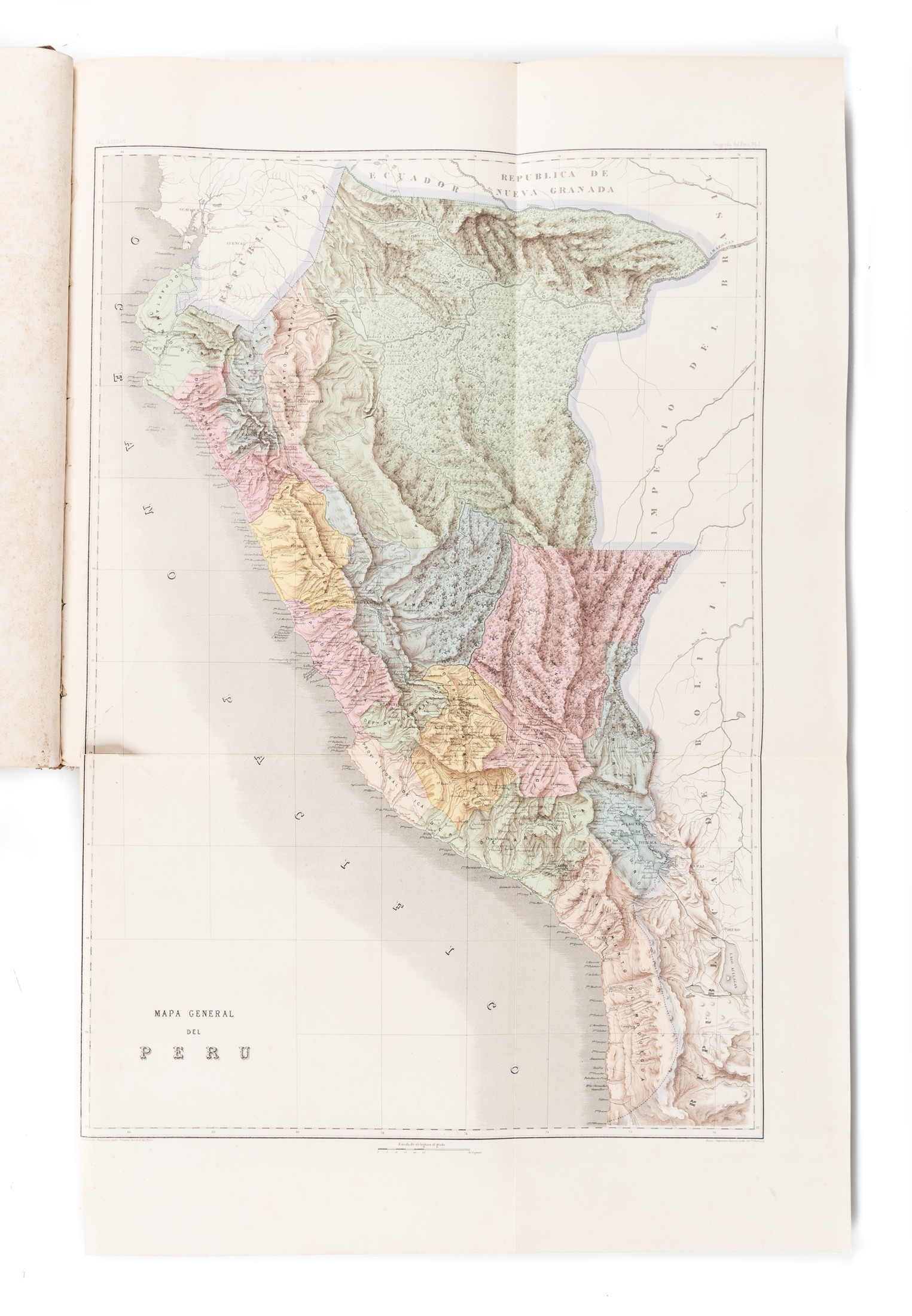
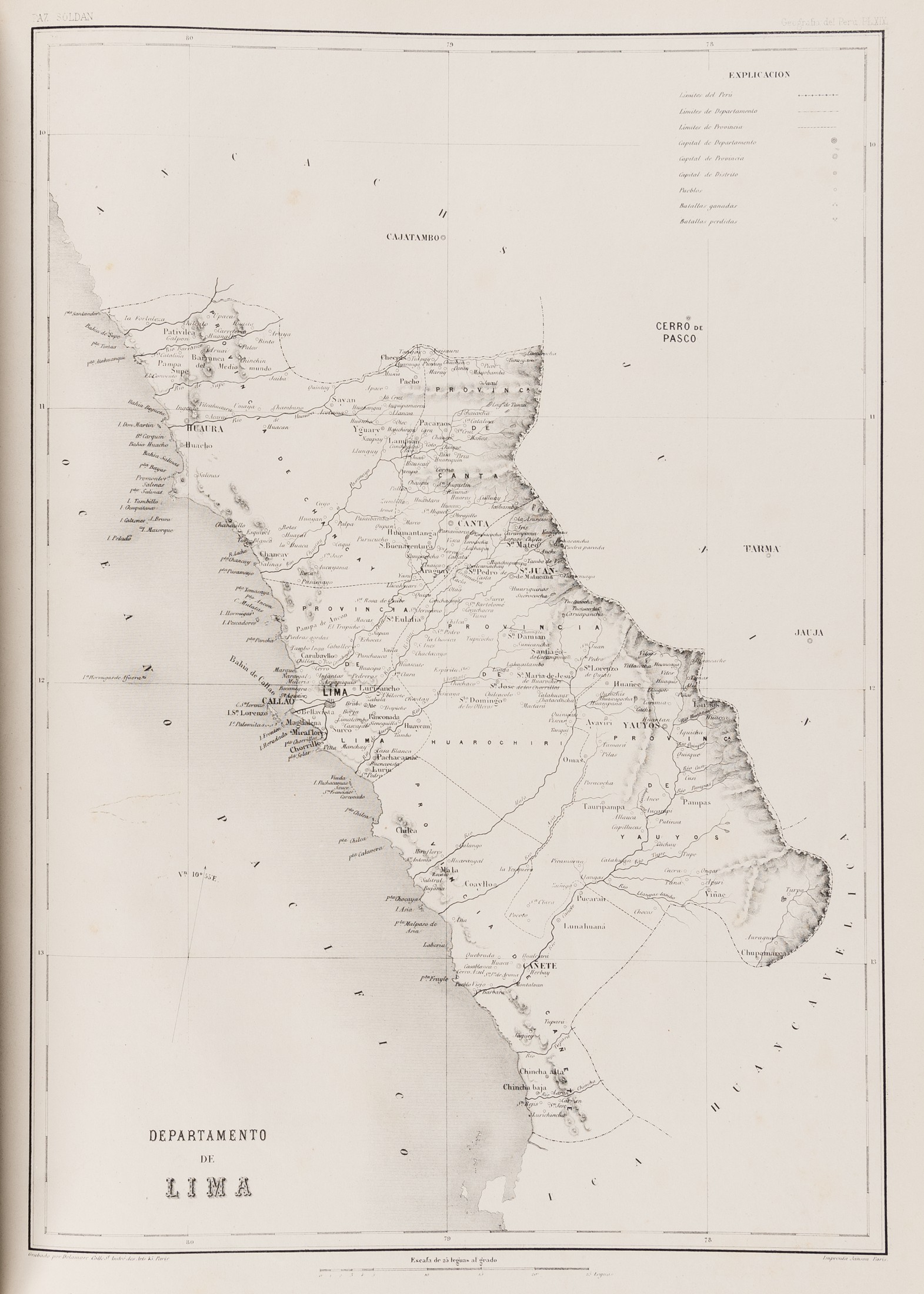
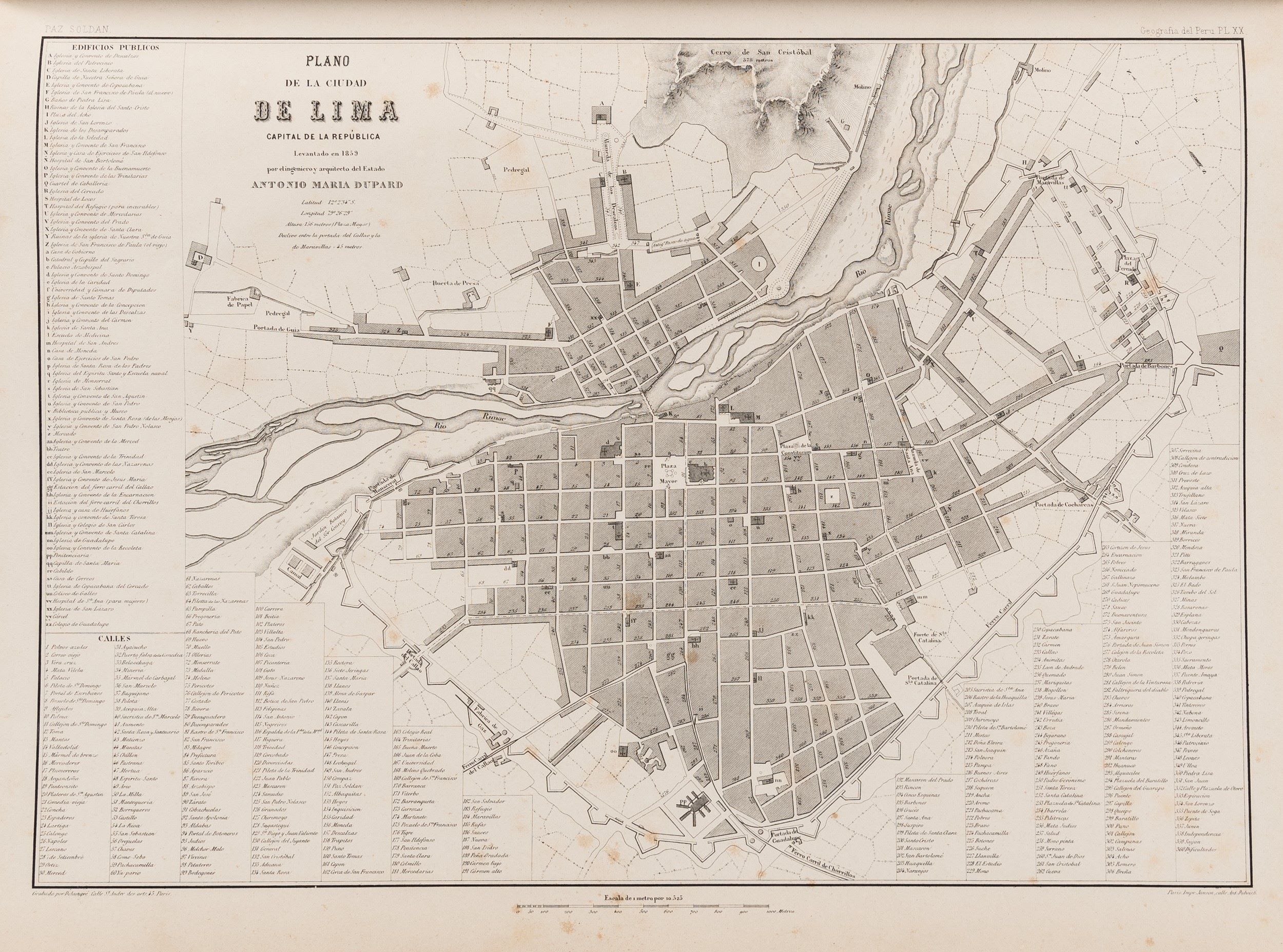
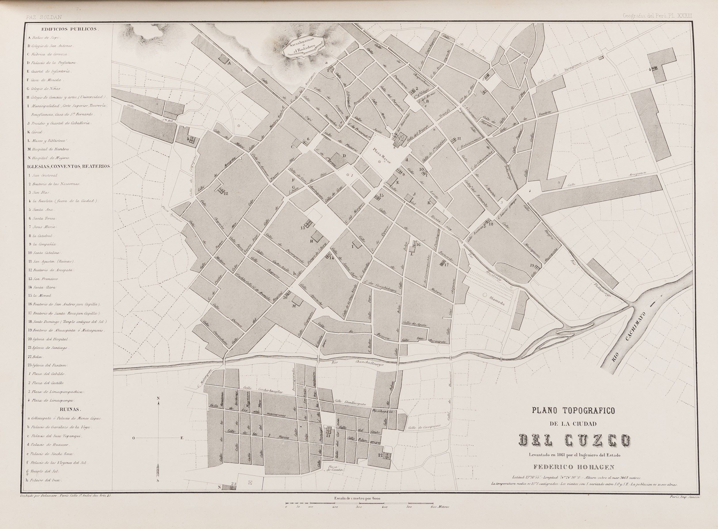
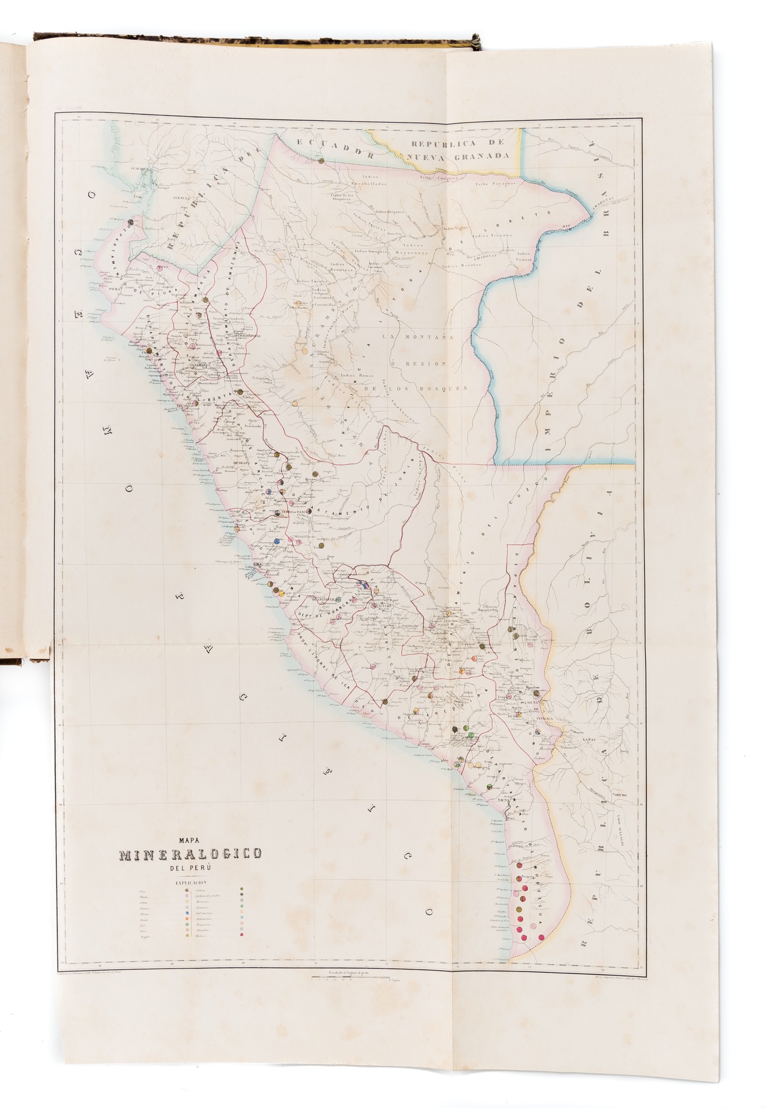
First Edition. Folio (525 x 388 mm); [1], 81, [1]pp., seventy-three plates, numbered to 67 with six additional (numbered bis or ter), comprising ten folding maps, one on two separate sheets, two in original outline colour, thirty-six full-page maps and plans, twenty-one full-page tinted plate sheets, three folding tinted plate sheets, including one large panorama, two full-page geological cross-sections in original colour. Plates 1, 36 and 53 with open tears from the stub, 36 also heavily browned. Contemporary quarter cloth with mottled paper-covered boards, extremities rubbed; cloth recently repaired. Paris : Fermin Didot Hermanos Hijos Y Ca,
Rare and important atlas of Peru.
This First Edition was printed for the French publishing house Firmin Didot in 1865, possibly as a preliminary edition, with at least one variant recorded. The atlas was quickly reprinted once the Peruvian Government took over the costs of publication. This second edition was dedicated to Presidente Ramon Castilla, while a second title-page recorded it as printed for the Libreria de Agusto Durand.
Paz Soldan (1821-1886) was the most important Peruvian historian in the nineteenth century, this volume prepared to accompany his history. A visually striking volume, it illustrates the country through a series of its finely prepared and executed maps, city plans, views and costume groups. The most impressive of all is the large folding panorama of Arequipa, Paz Soldan’s birthplace.
Stock Code: 186107


