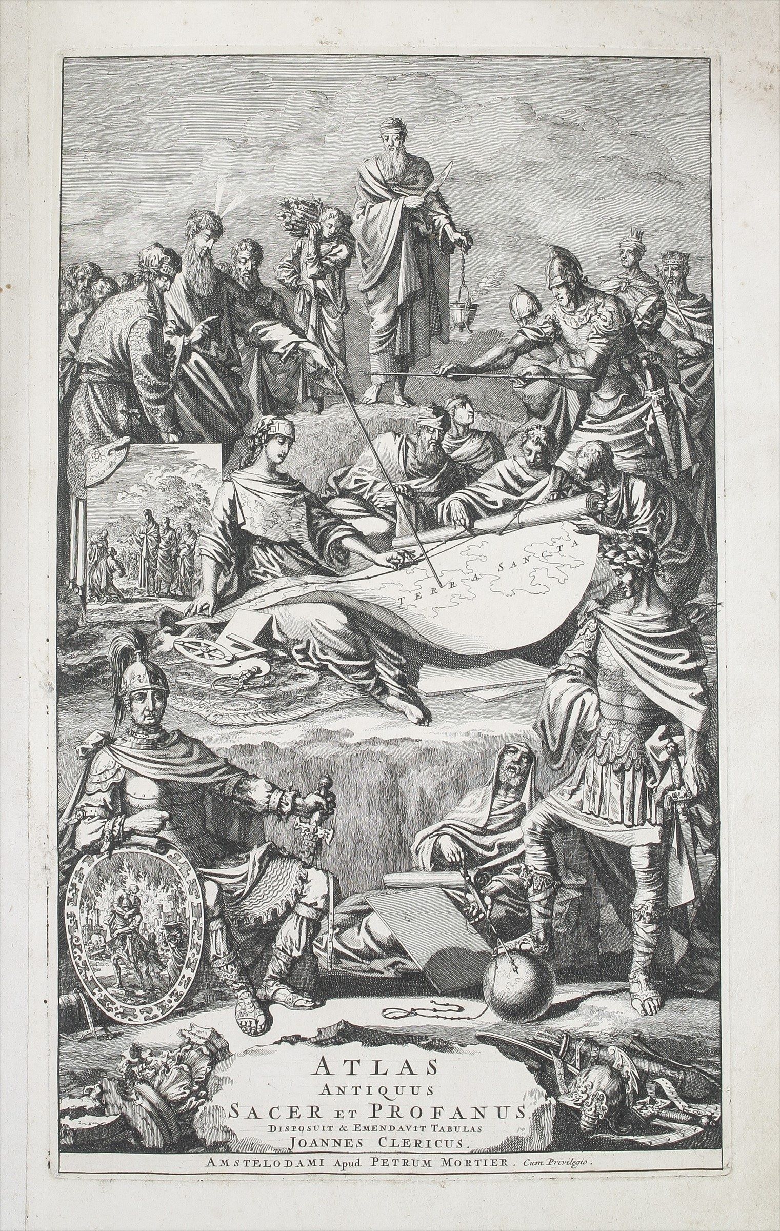
Atlas Antiquus, Sacer, Ecclesiasticus et Profanus; in quo Terrae Sanctae variae divisiones, Dioiesesium Patriarchalium & Episcopalium limites, Orbisque universus antiquus, prout erat olim excultus & divisus, oculis subjiciuntur; ... Collectus ex Tabulis Geographicis Nic. Sansonis, ejus Filiorum, aliorumque celebrium Geographorum. Tabulas ordine collocavit & emendavit Joannes Clericus. ...
LE CLERC Jean (1705.)
£20000.00 [First Edition]
Please contact us in advance if you would like to view this book at our Curzon Street shop.
First Edition; large folio (570 x 365 mm); elaborate pictorial engraved title-page, title-page, 5pp. Preface and Address to the reader, 1pp. index and eighty-nine double-page maps, as called for, in contemporary outline colour, a couple slightly creased and a couple with small tears. The maps are very good and bright, a few of the first and last leaves creased, some fraying to extreme margins. Recent quarter calf with later marbled paper-covered boards, seven raised bands and red morocco label with gilt lettering to spine; boards rubbed, corners slightly bumped and stained. With the engraved book-plate of John Orlebar (1697-1765). Amsterdam : Pieter Mortier,
Johannes le Clerc (1657-1736; alternatively Johannes Clericus) was a noted historian of the bible and classical period. Born in Geneva, he settled in Amsterdam, where he composed a series of histories.
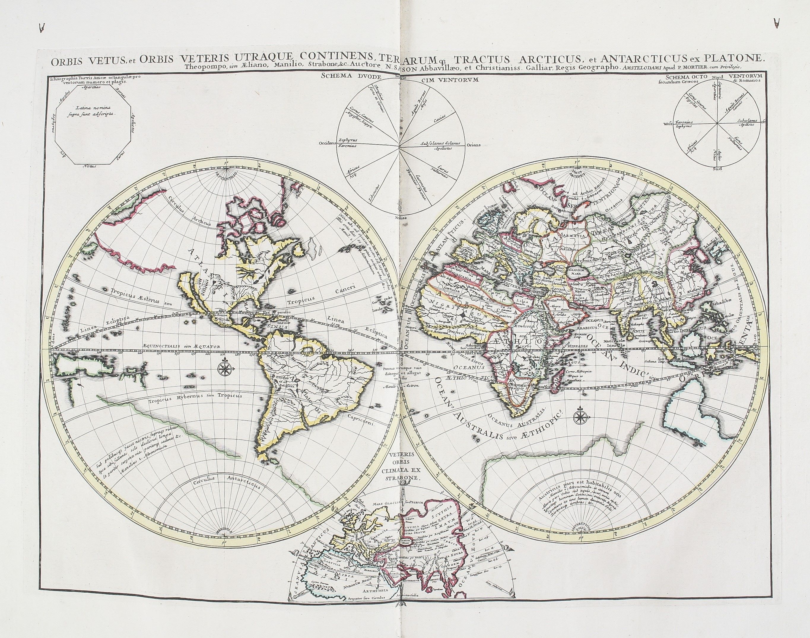
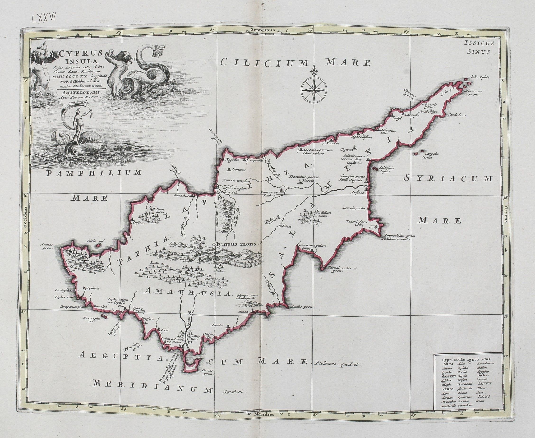
The most famous of these is his Atlas Antiquus, 1705, an atlas of the biblical and classical periods, illustrated with 89 maps, in imitation of Ortelius' Parergon, with maps copied from those by the Sanson family, Philippe de la Rue, Pierre Duval and others.
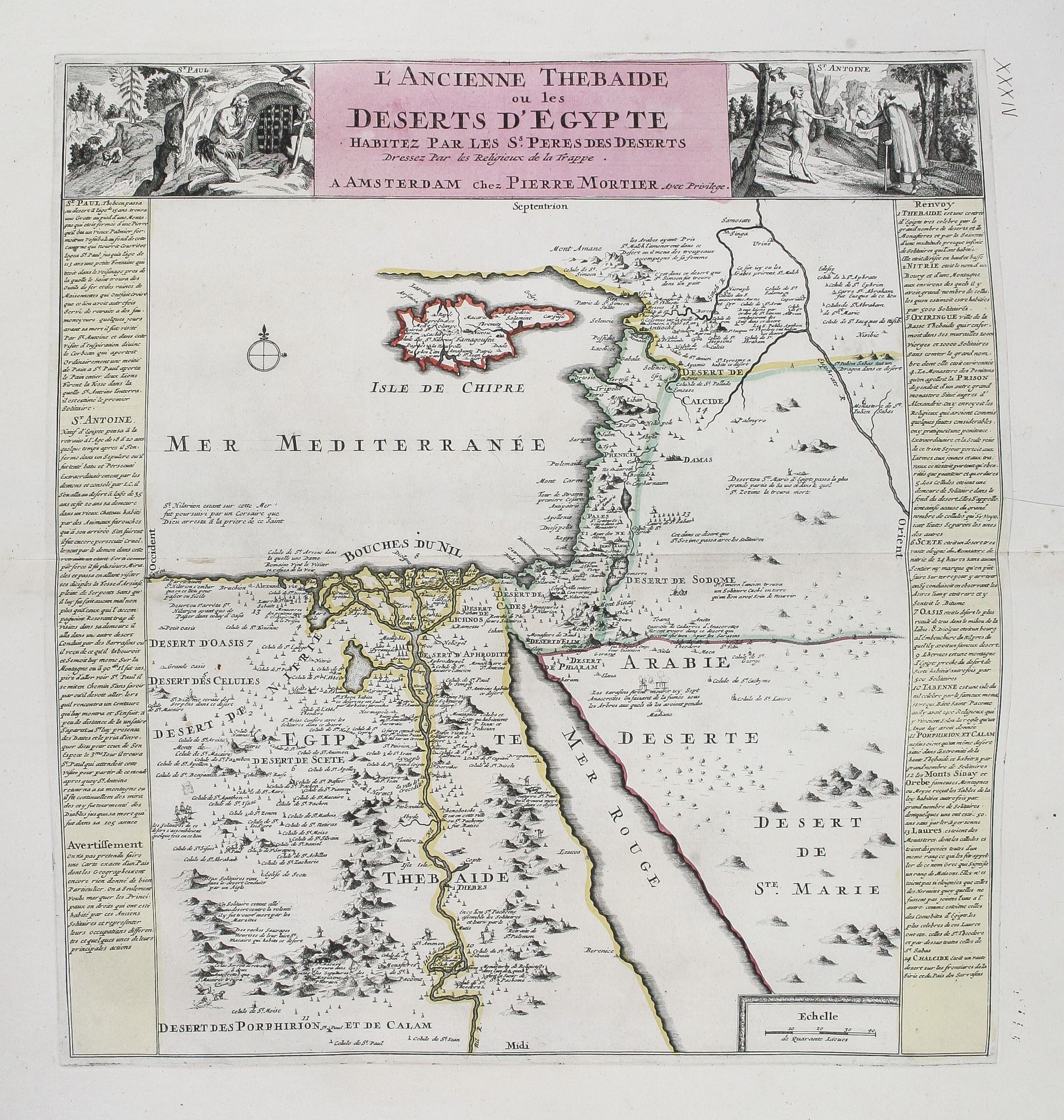
Thirteen maps are devoted to the Bible and the Holy Land, including a map of the location of Paradise, the Exodus, the settlement of the Promised Land, and division among the Twelve Tribes, a map of the Kingdom of Solomon, the Holy Land at the time of Jesus, his travels and those of the Apostles.
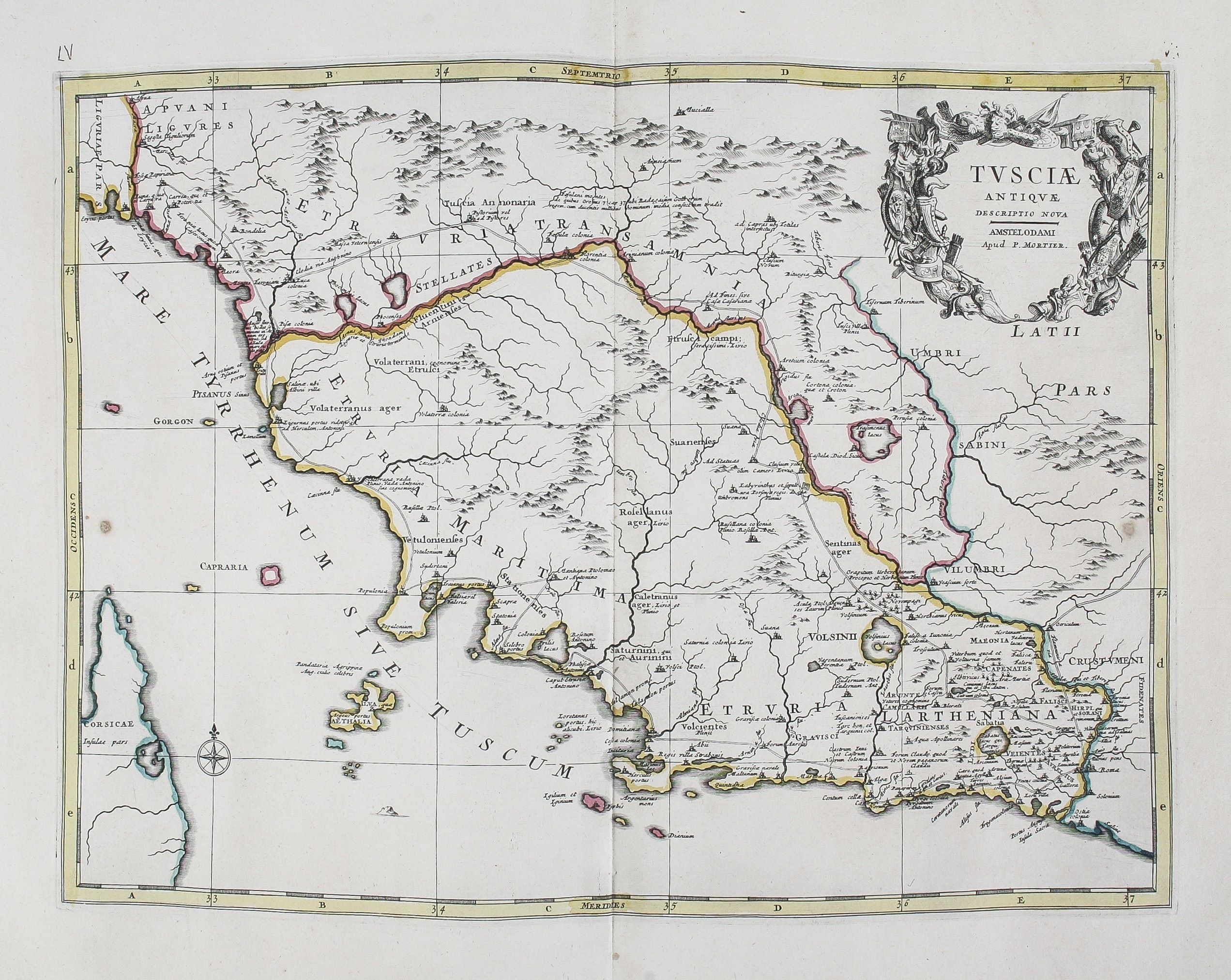
There is a sequence of maps of the bishoprics of the early Christian Church, locations of Trappist (hermit) monks in the desert, and maps of the regions of the classical world, including the Eastern and Western Roman Empire.
Eight maps depict eight famous military events from the classical period: the Trojan War, the voyages of Aeneas through the Mediterranean, and the campaigns of Alexander the Great, Pyyrhus, Hannibal and Caesar’s Gallic Wars.
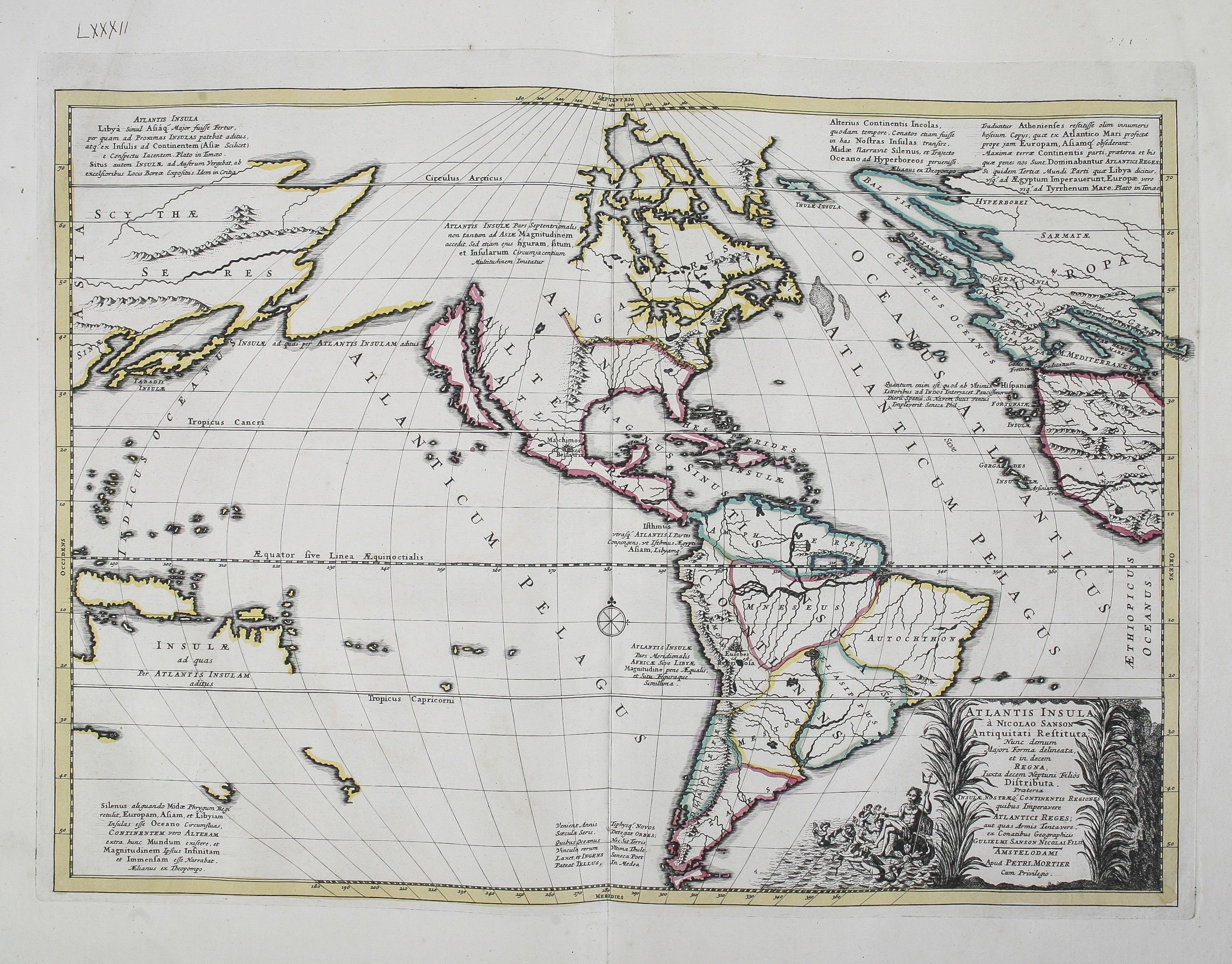
Among the most famous is the map of the Americas, positing that continent as the location of the legendary Atlantis.
Pieter Mortier was a leading Amsterdam map-publisher, famed for his editions of Alexis Hubert Jaillot’s elephant folio Atlas Nouveau. Of the many classical atlases, this is the largest in map numbers and format, and closest to rivalling Ortelius’ in quality of engraving, production and colouring, while being considerably scarcer.
Reference: Koeman, III, Mor 4; Shirley, T.CLER-1a.
Stock Code: 207479


