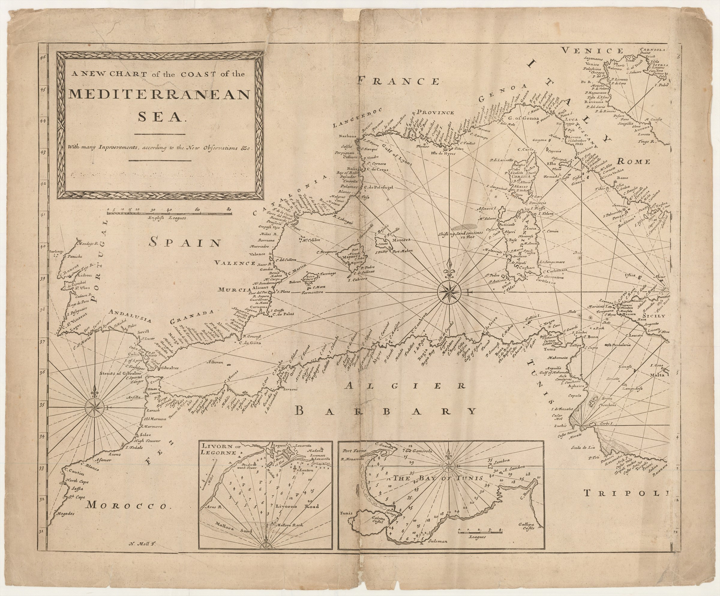
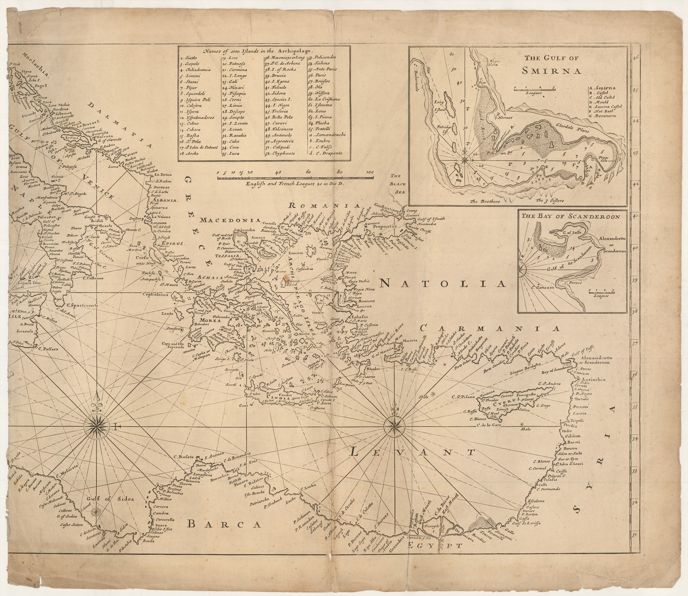
A New Chart of the Coast of the Mediterranean Sea With many Improvements, according to the New Observations &c. [erasure]
SELLER Jeremiah.; PRICE Charles sr. (ca. 1730])
£1000.00
Please contact us in advance if you would like to view this book at our Curzon Street shop.
Copper engraving on two sheets cut for joining and once joined, but now separated with some adhesion loss to the left-hand sheet, totaling 745 x 1105 mm; the left-hand sheet with repaired centrefold. [London : Mount & Page,
Very scarce general chart of the Mediterranean Sea originally published by Seller and Price in 1703, presumably intended for their edition of The English Pilot. Part III. Describing the Sea Coasts, Capes, Head-Lands, Bays, Roads, Harbours, Rivers and Ports, together with the soundings, sands, rocks and dangers in the whole Mediterranian Sea ..., published jointly with Richard Mount.
However, the only copy of the this edition in a British institution, in the British Library, was assembled and sold by Mount, who (not surprisingly) used his own chart of the Mediterranean; the chart is also found in Seller and Price's 'English Neptune', 1704. After the bankruptcy of Seller and Price, in 1705/1706, Mount acquired their stock of printing plates which his heirs utilised with the Seller and Price imprint erased, as here, in some subsequent editions of the Mediterranean.
The chart has details of the important (to the English) trading ports of Livorno, Tunis, Smyra and Alexandretta.
Stock Code: 222724


