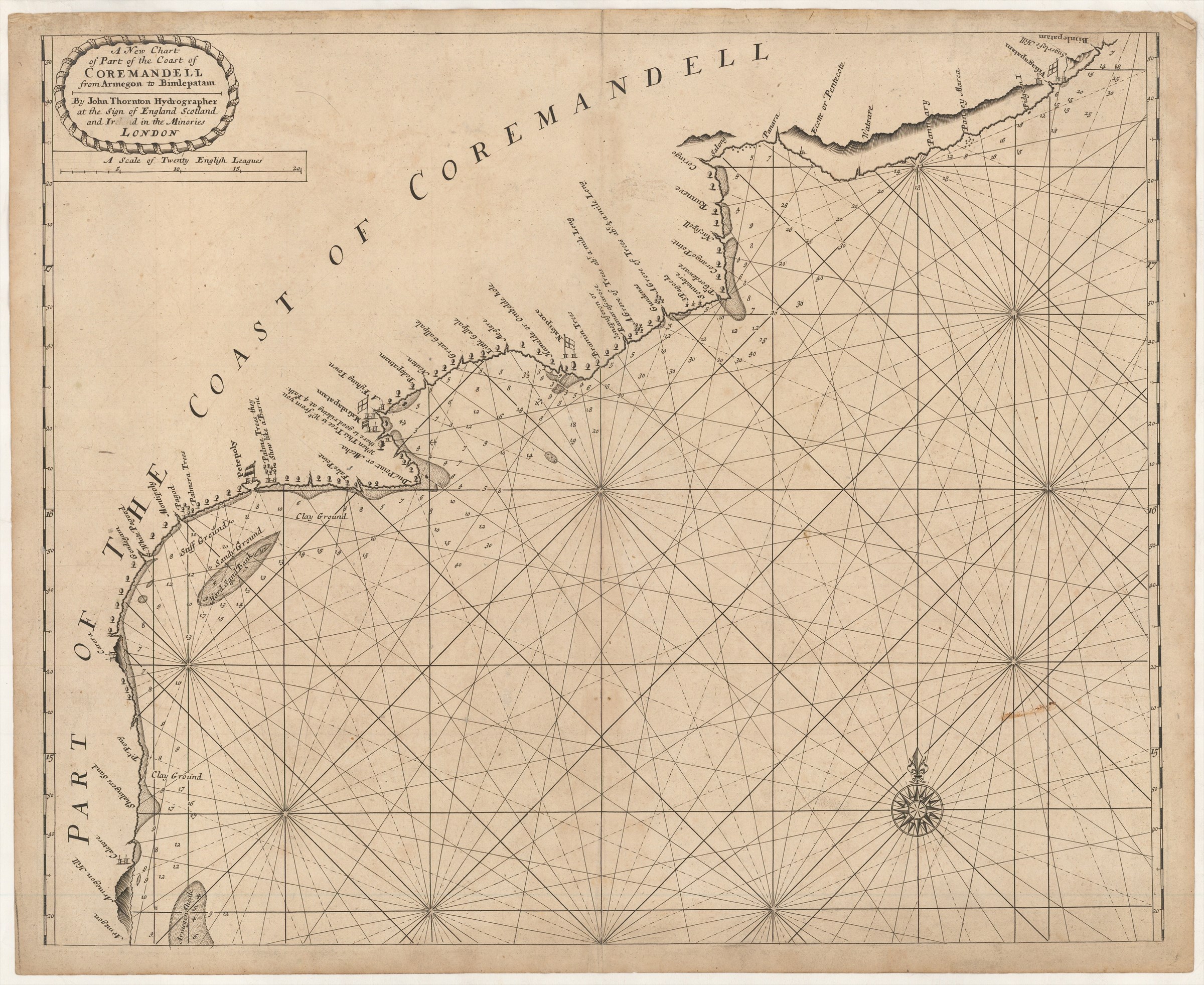
A New Chart of Part of the Coast of Coremandell from Armegon to Bimlepatam ...
THORNTON John (1703)
£1000.00
Please contact us in advance if you would like to view this book at our Curzon Street shop.
Double-page engraved chart, 430 x 530 mm. A very good example, in a good impression. London : John Thornton,
From The English Pilot. The Third Book. Describing the sea-coasts, capes, headlands, straits, soundings, sands, shoals, rocks and dangers. The islands, bays, roads, harbours and ports in the Oriental Navigation. ...
Rare English chart of this stretch of the Coromandel coast, the first detailed printed English delineation of the area, prepared for the 'Third Book' of the English Pilot', which is devoted to the "Oriental Navigation" the sea route from England to the Far East. Small flags represent the trading posts along the coast, with the English flag visible at 'Massulapatam', 'Nassipore' and 'Visigapatam', and French flags at 'Massulapatam' and 'Petepoly'.
This is the first state of the chart, with the imprint of John Thornton; it appeared thus only in the first edition of the 'Third Book', published in 1703, which is recorded in four institutional locations.
The plate remained in use until 1761, by which time the plate was heavily worn; this early impression emphasises the quality of Thornton's chart-making and engraving.
Stock Code: 222728


