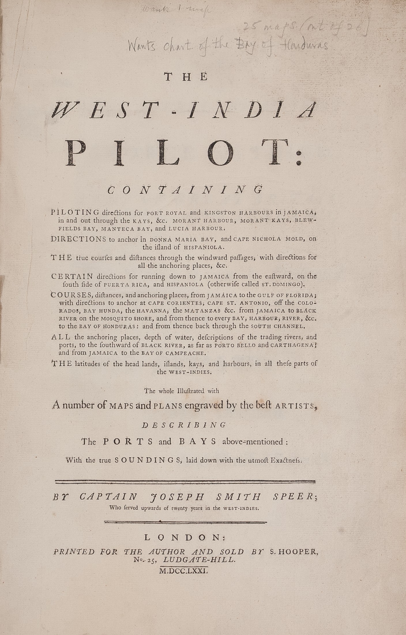
The West-India Pilot ...
SPEER Joseph Smith (1771.)
£18500.00

Please contact us in advance if you would like to view this book at our Curzon Street shop.
WEST INDIES AT THE EVE OF THE REVOLUTIONARY WAR
The whole illustrated with a number of maps and plans engraved by the best artists describing the ports and bays ...
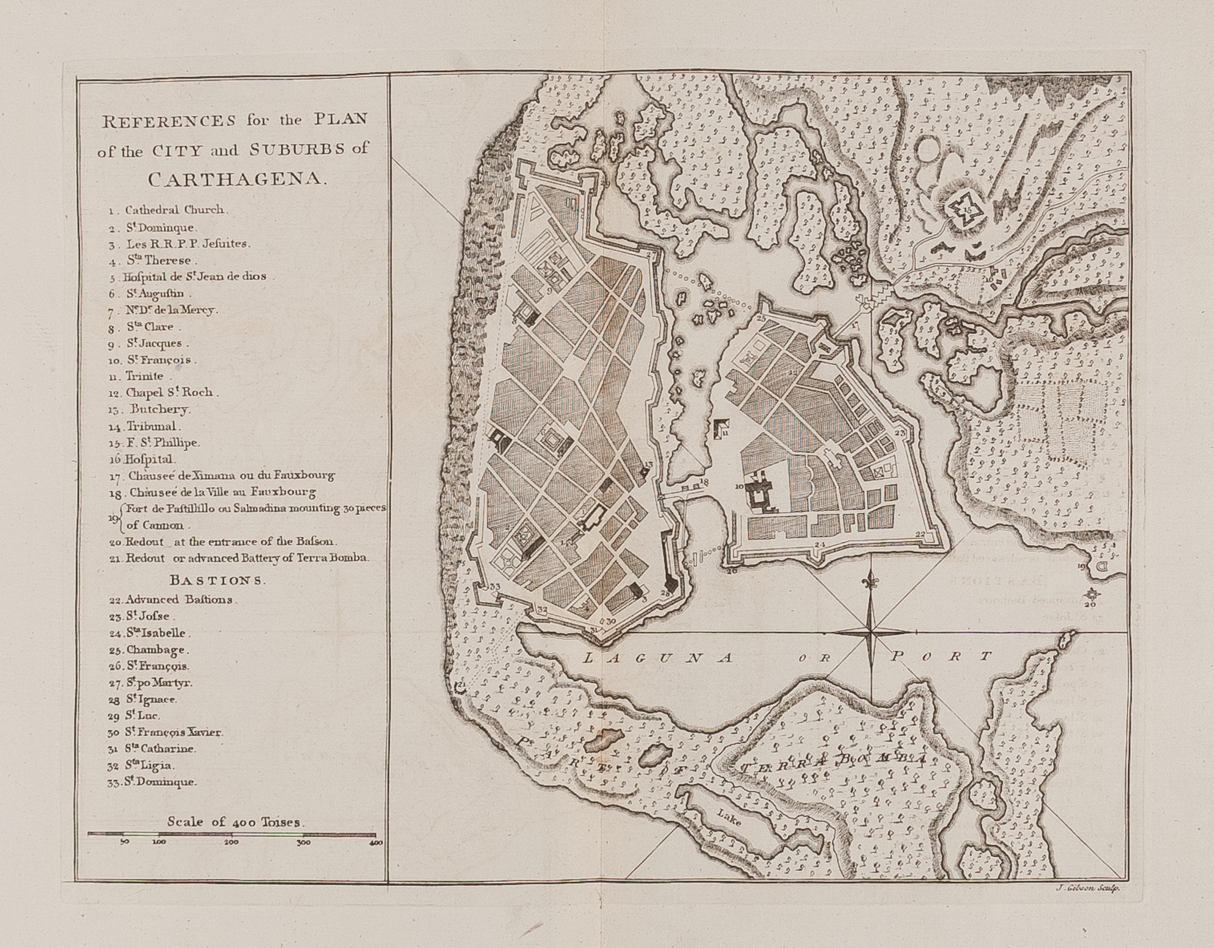
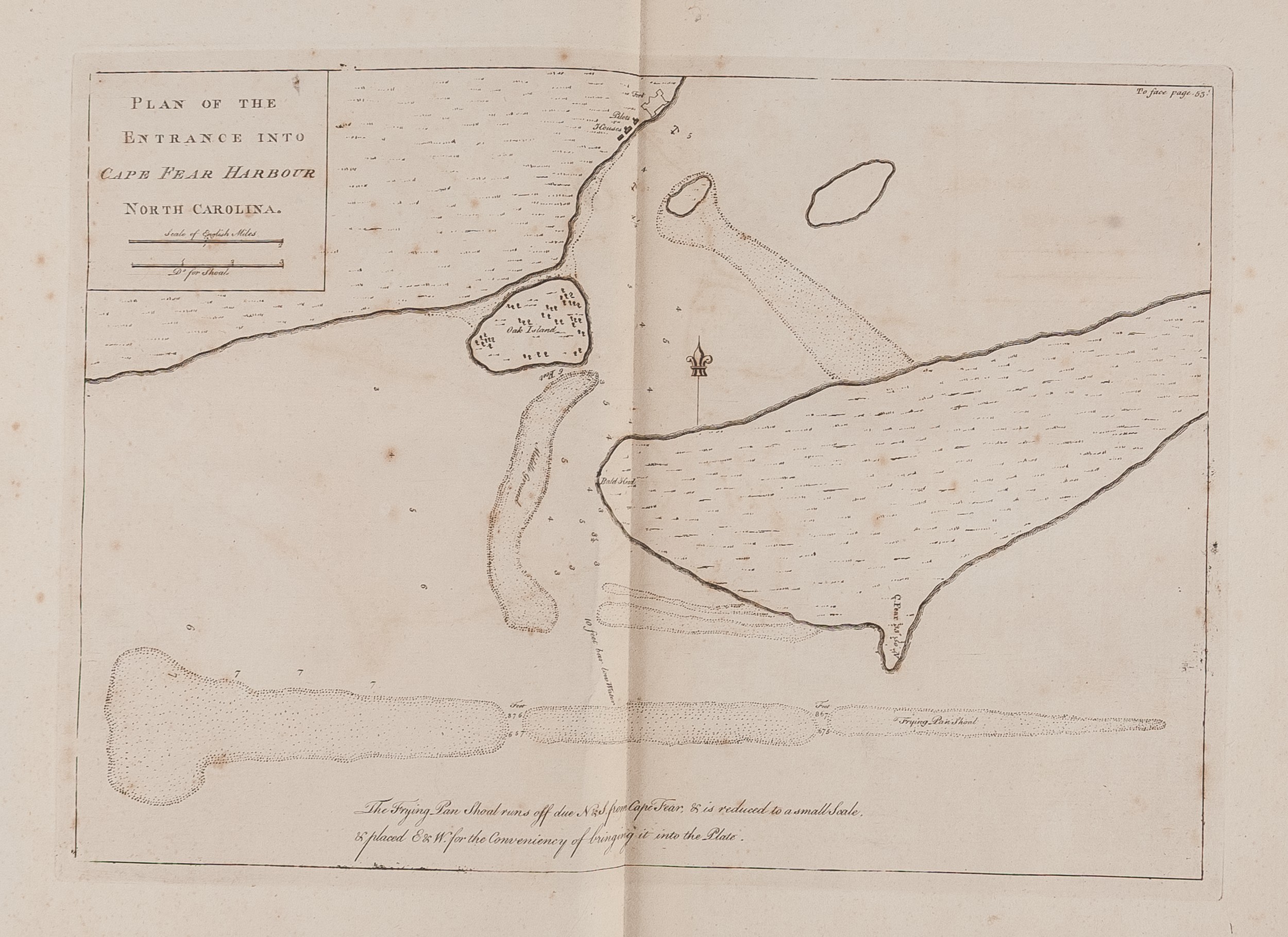
Second edition, first issue. Folio (413 by 260 mm). 25 charts (of 26, lacking the Bay of Honduras), one folding, one single-page, with Havana and Carthagena Harbour both dated October 1st 1771. The Cape Nicola Mole chart with paper flaw, separated, into the printed area. Recent half calf over marbled boards, spine gilt. Title-page, dedication leaf, 2pp, preface, [4], 67, [1]pp. London, Samuel Hooper for Joseph Smith Speer,
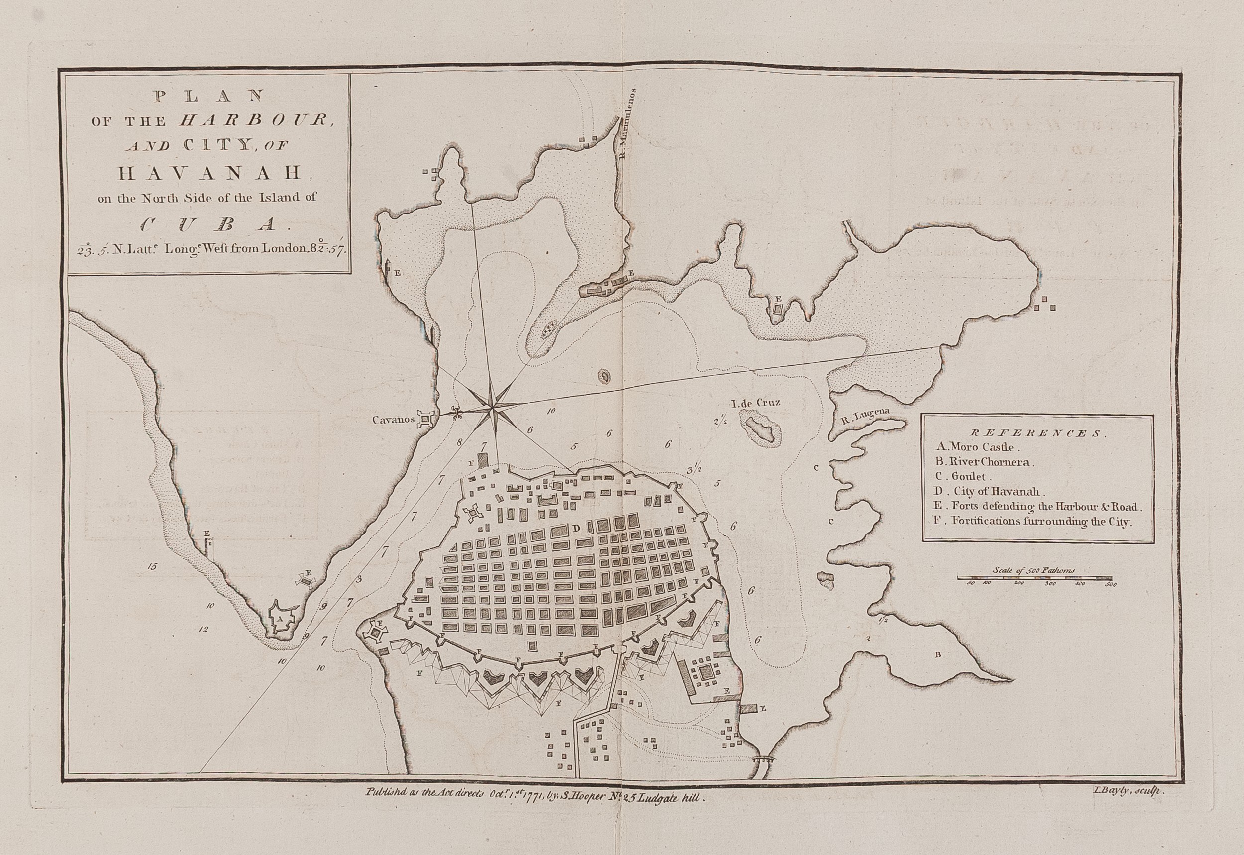
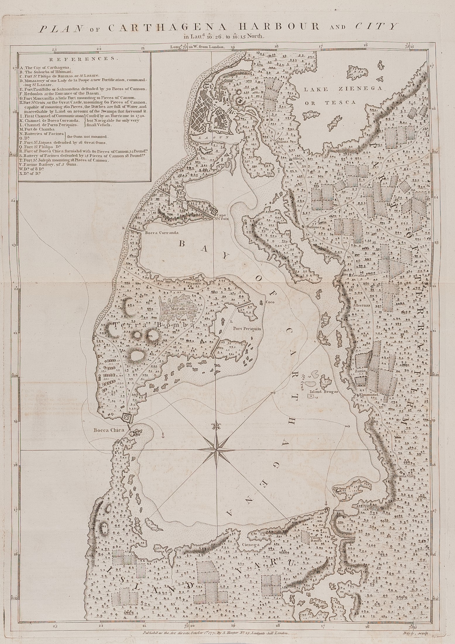
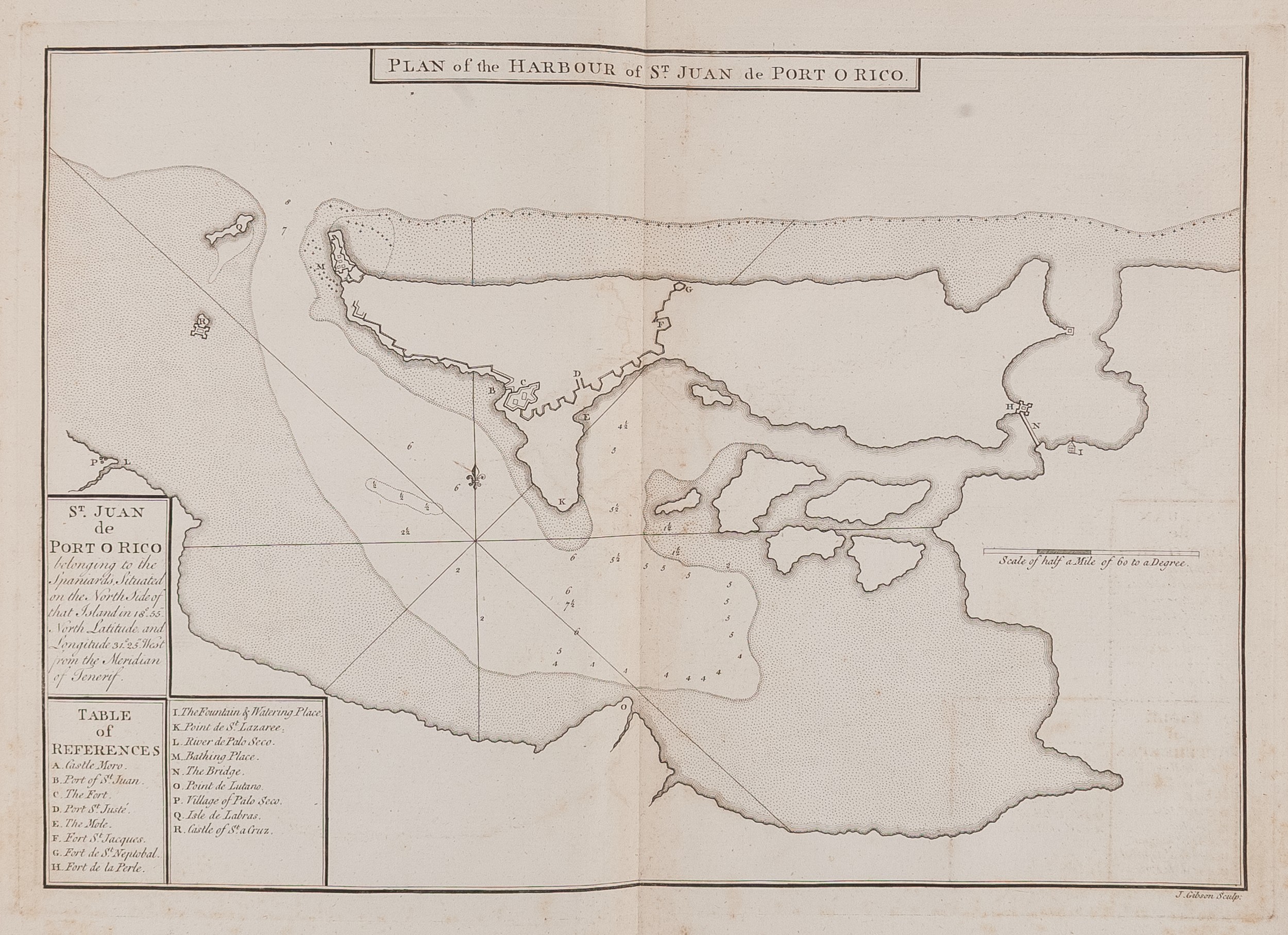
A very scarce pilot guide of the West Indies in excellent condition. This is much expanded from the first edition of 1766, which only had 13 maps. The guide contains charts of two North American harbours, Cape Fear Harbour and Jekil Sound (sic), as well as five in Jamaica (Port Royal, Port Antonio, Blewfield's Harbour, Lucia Harbour, and Mantica Bay); two of Havana; Cap Francois and Cape Nicola Mole in Hispanola; Port St Fernando de Omoa in Honduras, Port Orico Puerto Rico. Port au Prince, Port Paix in Haiti, as well as Carthagena, Vera Cruz and Puerto Vello and others.
An important snap shot of knowledge of the West Indies at the eve of the Revolutionary War. Each of these maps are augmented by sailing directions and the final page is a catalogue advertising select items from Hooper's stock.
ESTC calls for two pages of subscribers names, not present here, and not listed by Shirley. Sabin, 89248; Shirley (BL) M.SPR-1b.
Stock Code: 223219


