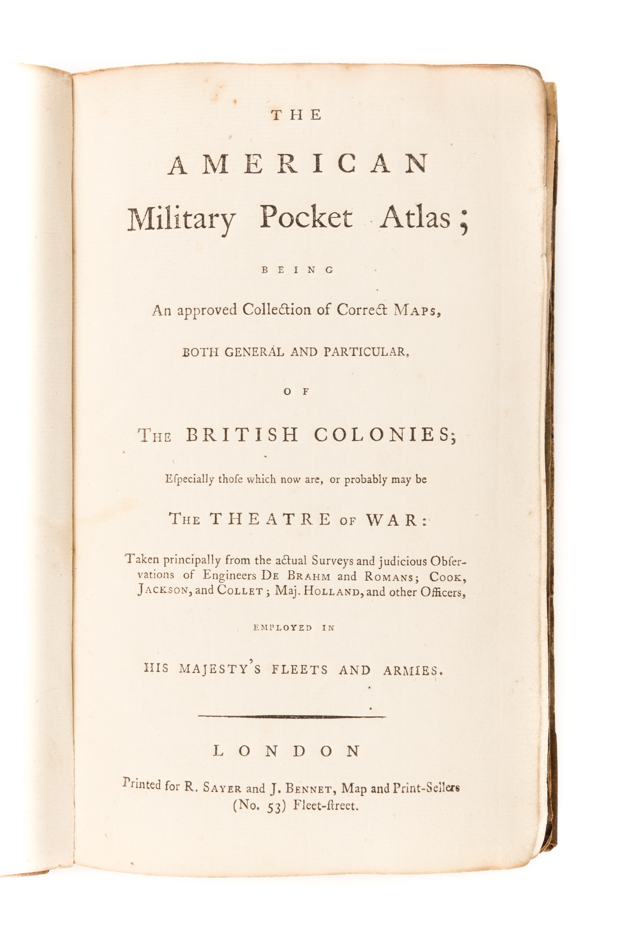
The American Military Pocket Atlas
SAYER Robert.; BENNETT John ([1776].)
£15000.00 [First Edition]


Please contact us in advance if you would like to view this book at our Curzon Street shop.
THE HOLSTER ATLAS
being an approved collection of correct maps, both general and particular, of the British Colonies, especially those which are now, or probably may be, the theatre of war.
First edition. 6 folding engraved maps, hand-coloured in outline. 8vo. Contemporary quarter calf over marbled boards, maps soiled & frayed at edges, some discoloration at folds, rebacked. London, Printed for R. Sayer and J. Bennett,
Published at the behest of Governor George Pownall, the advertisement clarifies its purpose: "Surveys and Topographical Charts being fit only for a Library, such maps as an Officer may take with him into the Field have been much wanted. The following Collection forms a Portable Atlas of North America, calculated in its Bulk and Price suit the Pockets of Officers of all Ranks." The six maps here represent a distillation of what the British high command saw as the most pertinent topographical information for soldiers and, being issued at the war's outset, provides keen insight into how the British envisioned the war unfolding. As with this copy, the atlas was usually folded down to octavo size. Not quite small enough to fit in a pocket, it was generally carried in a soldier's holster and soon was referred to as the holster atlas.
The six maps are:
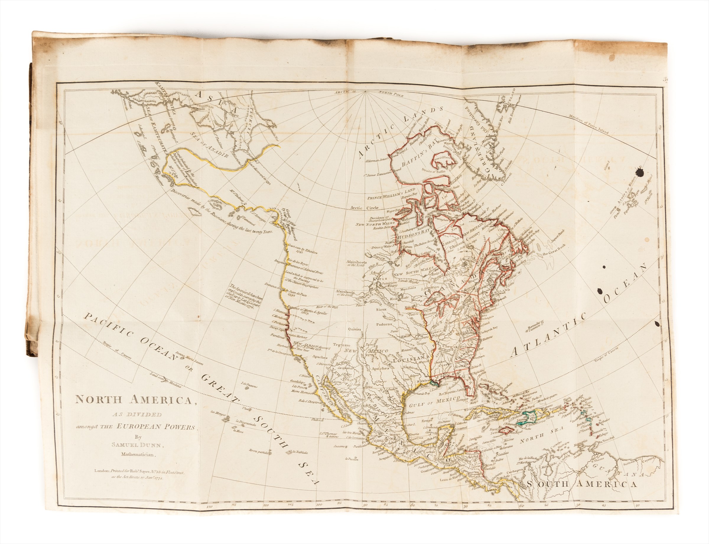
1. DUNN (Samuel). "North America, as Divided Amongst the European Powers. By Samuel Dunn, Mathematician." Engraved map, hand-coloured in outline measuring 13 1/2 by 18 1/4 inches. London, printed for Robt. Sayer, Jan. 10, 1774. Engraved for Dunn's A New Atlas , London, 1774.
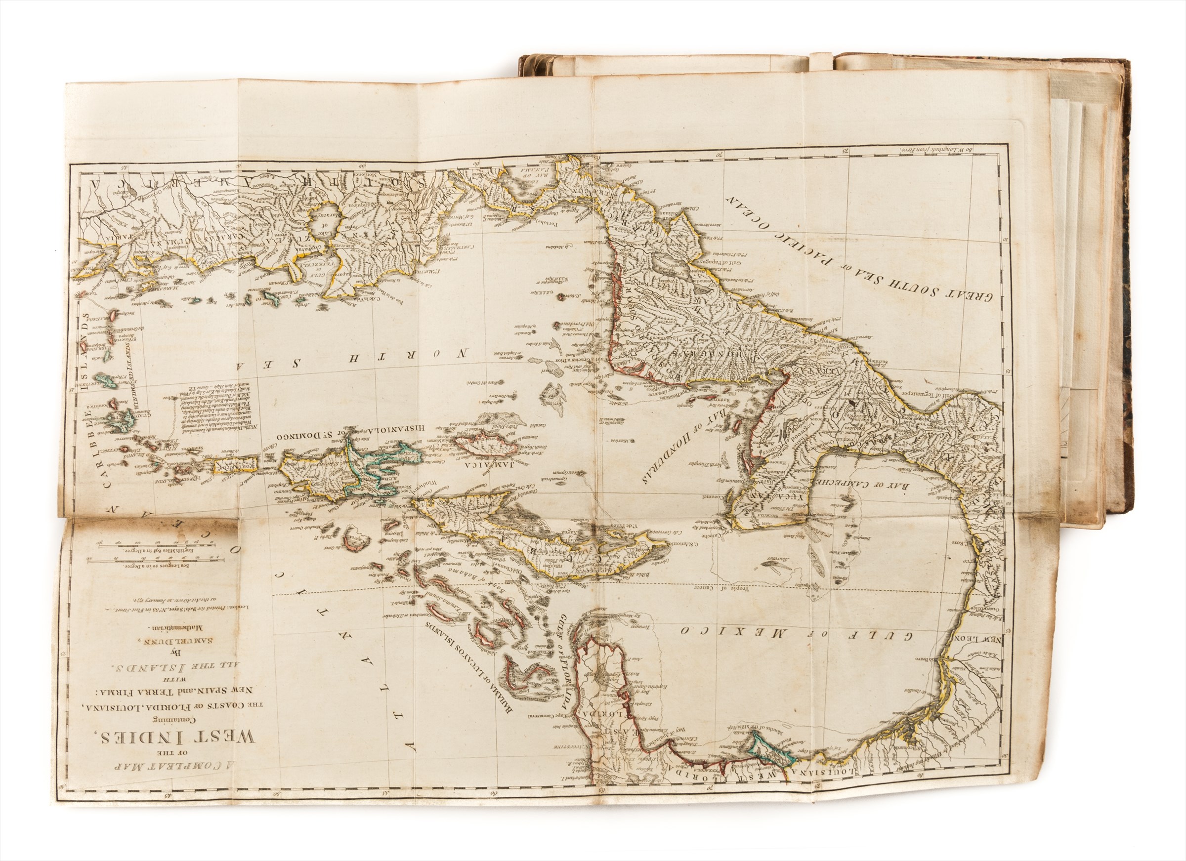
2. DUNN (Samuel). "A Compleat Map of the West Indies, Containing the Coasts of Florida, Louisiana, New Spain, and Terra Firma: with all the Islands." Engraved map, hand-coloured in outline measuring 13 1/4 x 18 1/2 inches). London, Robt. Sayer, Jan. 10, 1774. Engraved for Dunn's A New Atlas London, 1774.
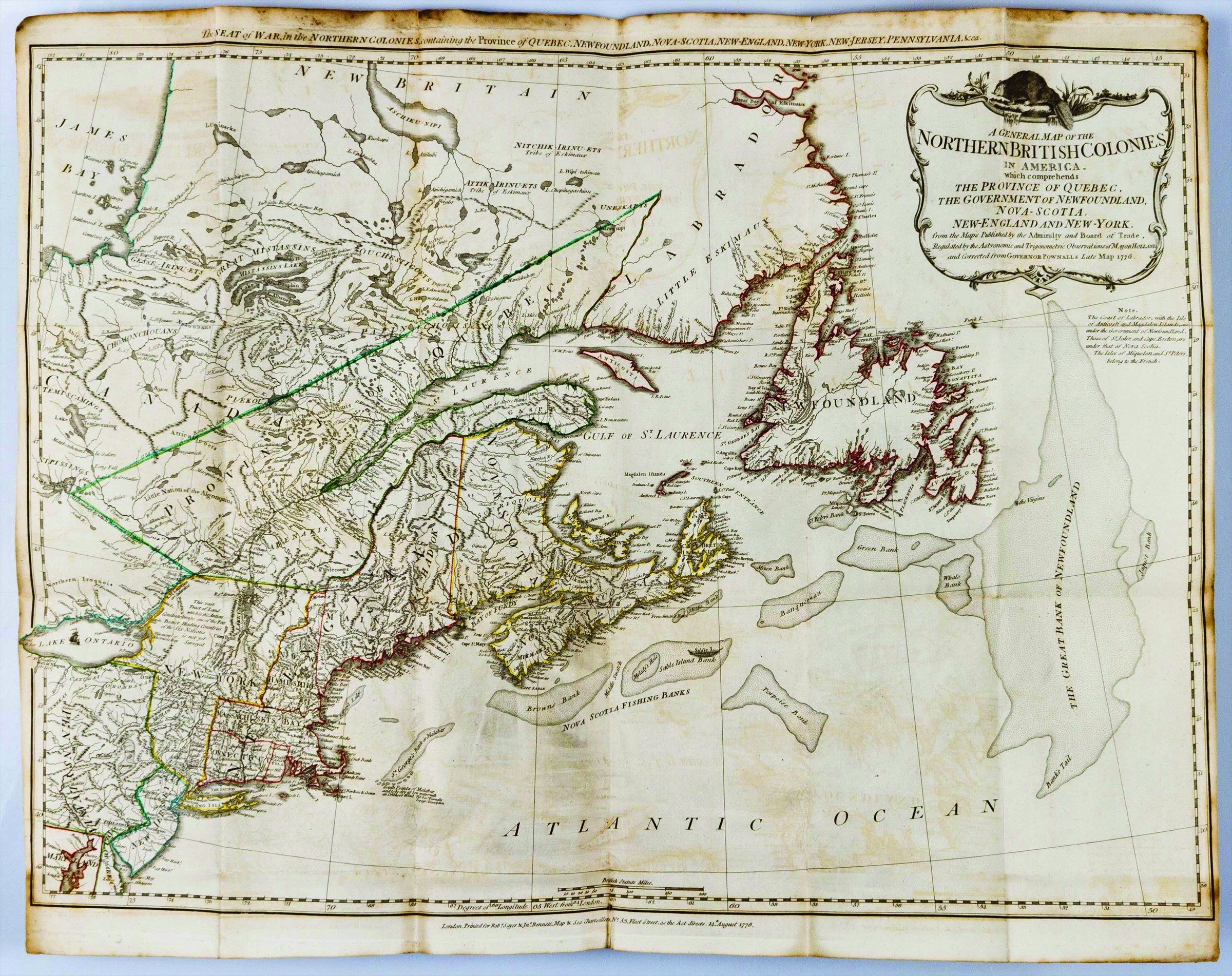
3. "A General Map of the Northern British Colonies in America. Which comprehends the province of Quebec, the Government of Newfoundland, Nova-Scotia, New-England and New-York. From the Maps Published by the Admiralty and Board of Trade, Regulated by the Astronomic and Trigonometric Observations of Major Holland and corrected from Governor Pownall's Late Map 1776." Engraved map, hand-coloured in outline measuring 20 3/4 by 26 3/4 inches. London, Robt. Sayer & Jno. Bennet, Aug. 14, 1776. A very good copy, here in its first state. The map also issued separately and was re-issued in 1788 with an updated title.
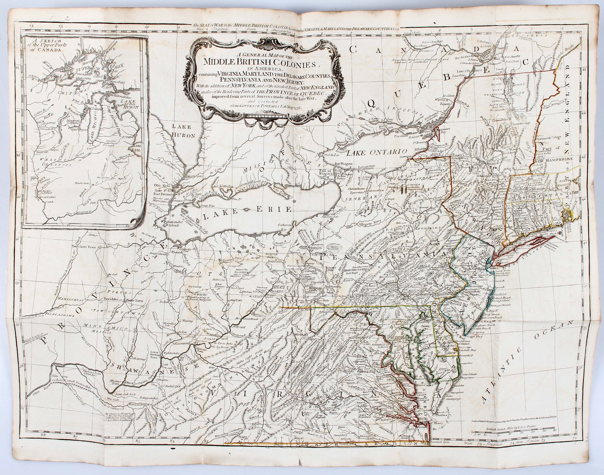
4. EVANS (Lewis). "A General Map of the Middle British Colonies in America. containing Virginia, Maryland, the Delaware Counties, Pennsylvania and New Jersey. with the addition of New York, and the greatest part of New England, as also of the bordering parts of the Province of Quebec, improved from several surveys made after the late war, and corrected from Governor Pownall's Late Map 1776." Engraved map, hand-coloured in outline measuring 20 1/2 by 26 3/4 inches. London, R. Sayer & J. Bennet, Oct. 15, 1776. Based on the 1755 Lewis Evans map, with subsequent corrections.
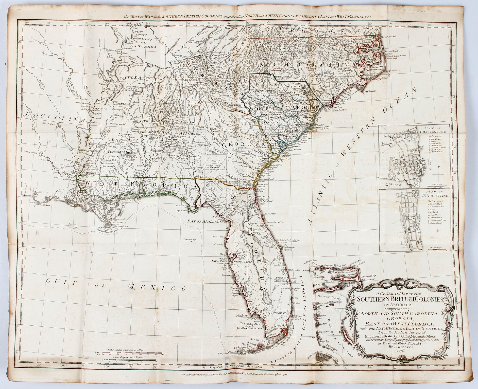
5. ROMANS (Bernard). "A general map of the Southern British Colonies, in America. comprehending North and South Carolina, Georgia, East and West Florida, with the neighbouring Indian countries. From the modern surveys of Engineer de Brahm, Capt. Collet, Mouzon & others; and from the large hydrographical survey of the coasts of East and West Florida. By B. Romans." Engraved map, hand-coloured in outline measuring 20 3/4 by 25 5/8 inches. London, R.Sayer & J. Bennett [sic.], 15 October. 1776. Based on charts and maps by Roman and others.
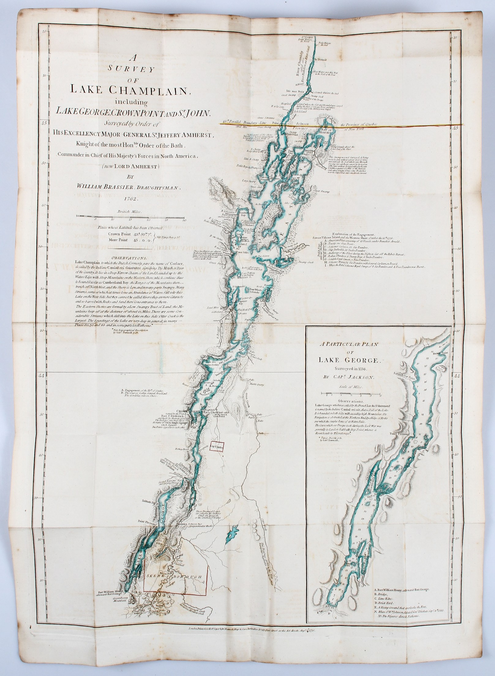
6. BRASSIER (William Furness). "A Survey of Lake Champlain including Lake George, Crown Point and St. John, Surveyed by order of ... Sr. Jeffery Amherst ... by William Brassier, draughtsman. 1762." Engraved map, hand-coloured in outline measuring 29 1/8 by 21 5/8 inches. London, Robt. Sayer & Jno. Bennet, 5 Aug., 1776. Also issued as the first separately published map of Lake Champlain, this chart was based on a survey made during the French and Indian War, but not published until the Revolution. Included is an inset illustrating America's first naval battle, in which General Benedict Arnold, though forced back down the lake, was able to delay the British attempt to descend to the Hudson for that year.
Howes, A208; Nebenzahl Atlas of the American Revolution pp.61-63; Phillips Atlases, 1206; Sabin, 1147; Schwartz & Ehrenberg, Mapping of America, 190.
Stock Code: 212045


