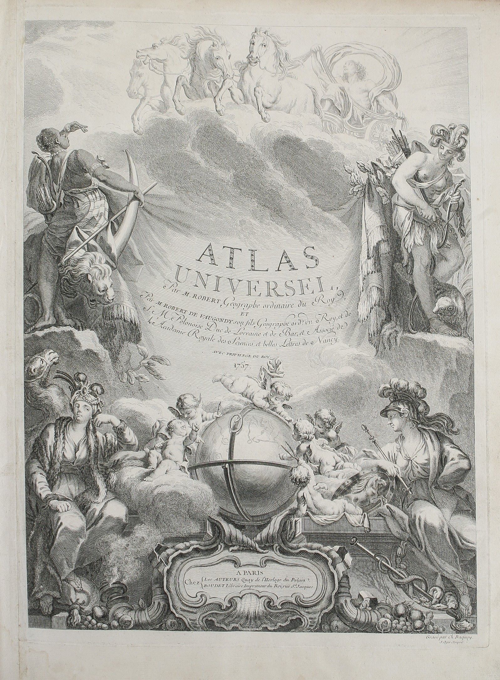
Atlas Universel ...
ROBERT DE VAUGONDY Gilles.; ROBERT DE VAUGONDY Didier (1757.)
£12500.00
Please contact us in advance if you would like to view this book at our Curzon Street shop.
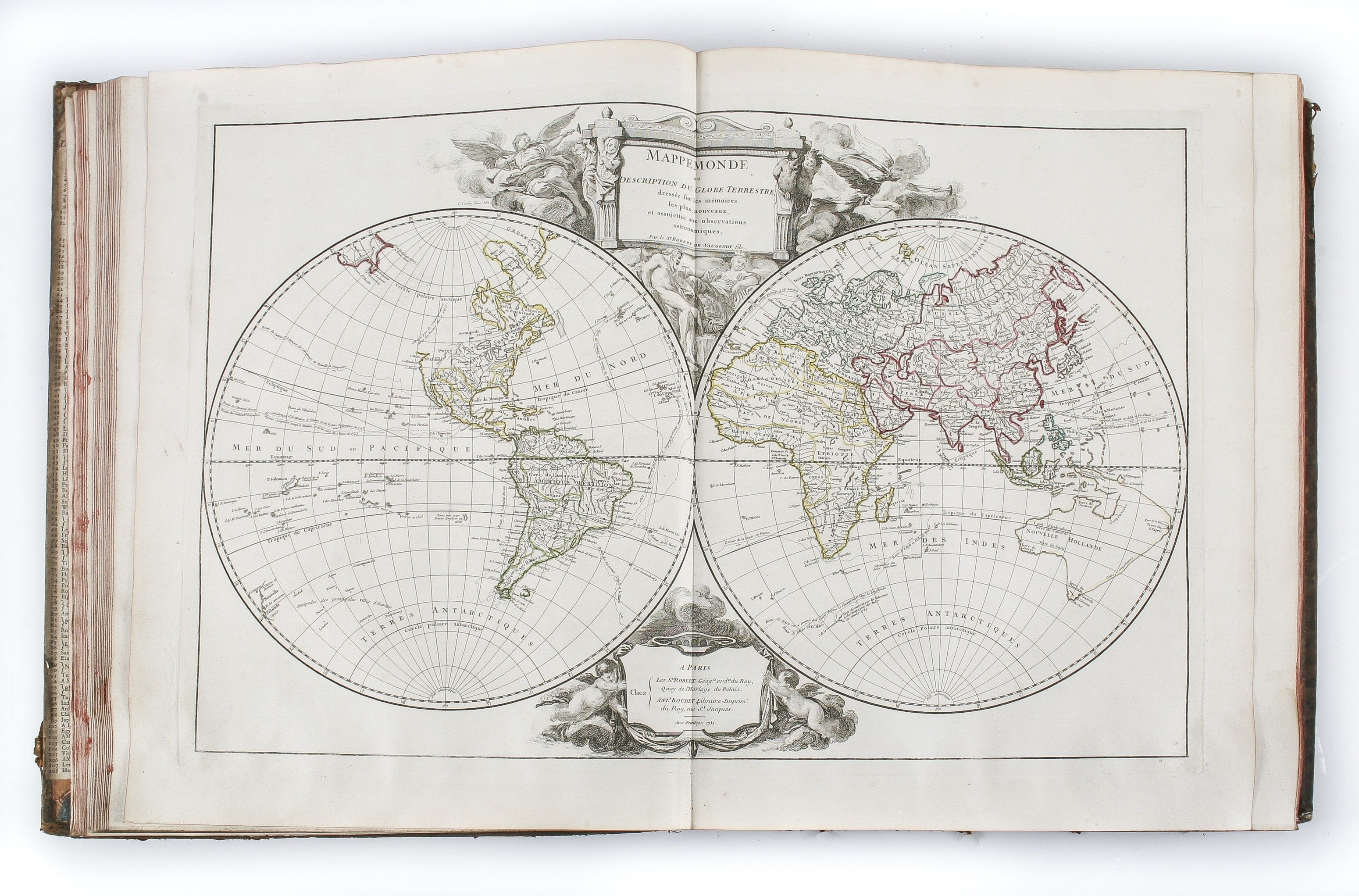
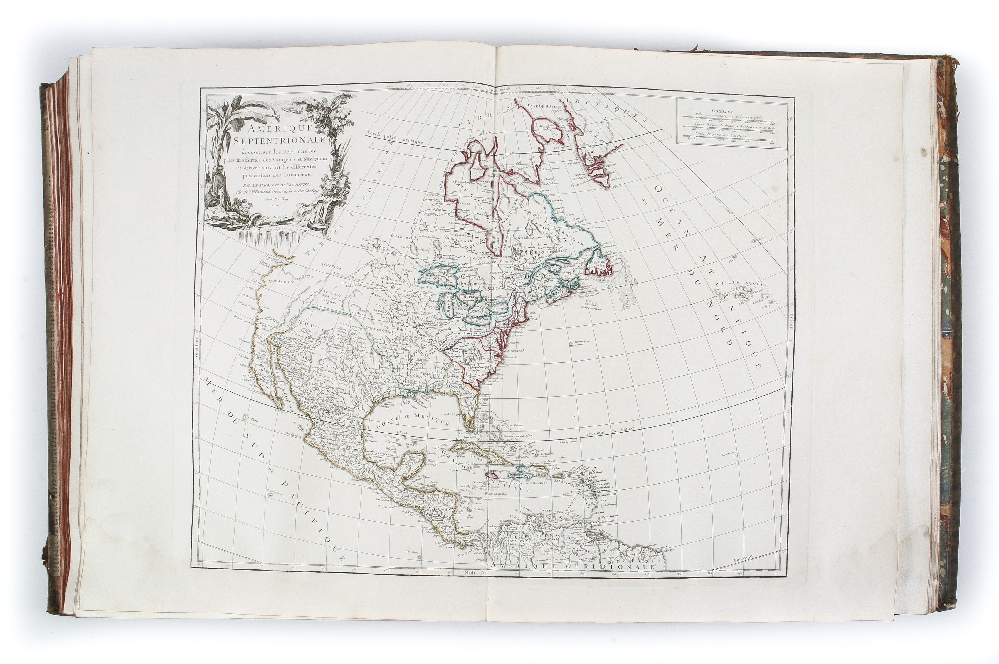
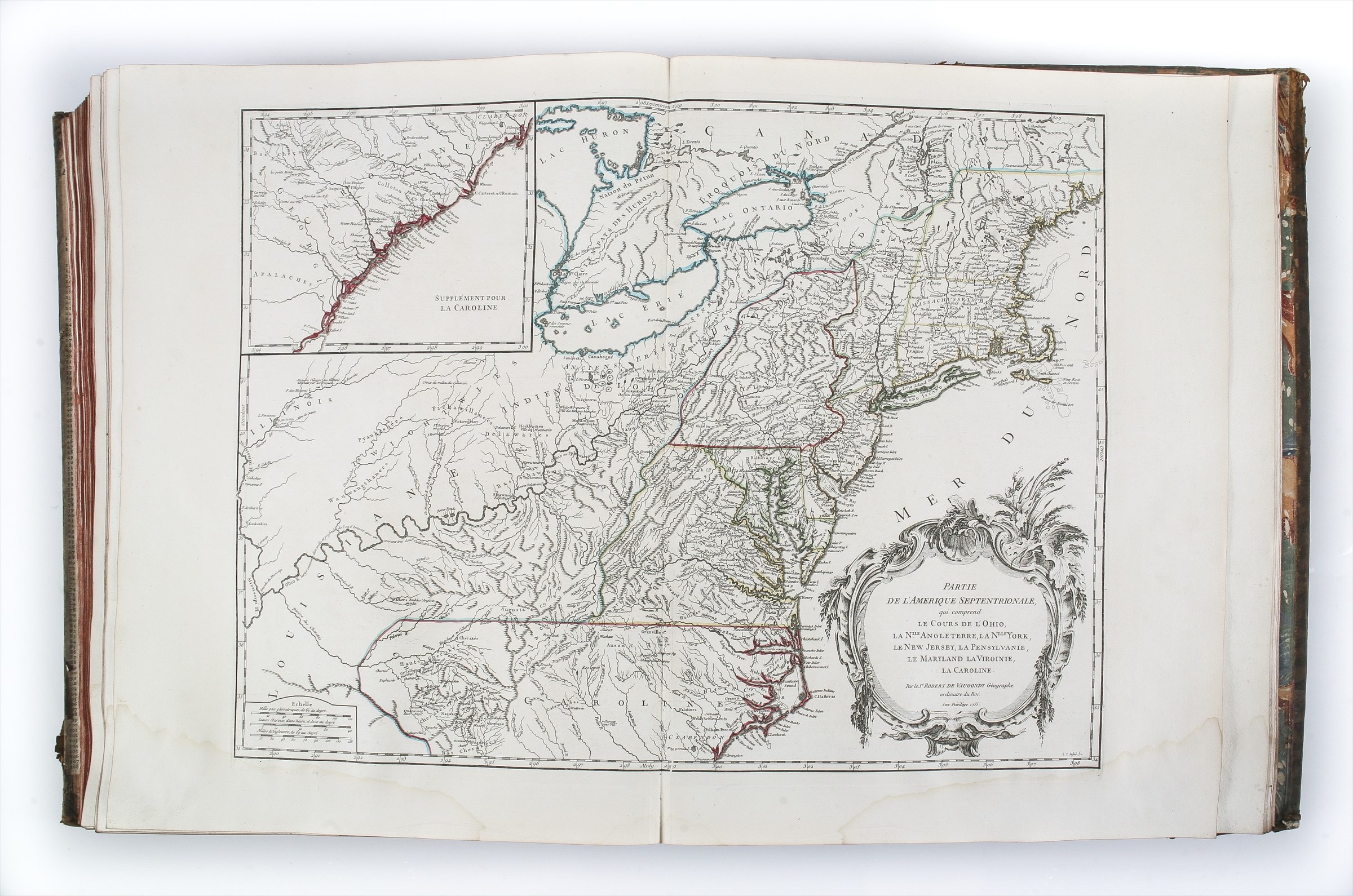
Large folio (560 x 445 mm); engraved title-page, 2pp. introduction, 34pp. geographical text with index page, 6pp. subscription list calling for 517 subscribers; 108 double-page engraved maps in original outline colour, listed in a letterpress table pasted to the front end-paper, twelve of the ancient world, 96 modern maps. Some light waterstaining along the lower border. Contemporary cat’s paw calf, professionally rebacked and repaired, old spine laid down with seven raised bands, gilt decoration and red morocco label; extremities slightly worn, some minor loss to decoration on spine. Paris : Gilles & Didier Robert de Vaugondy,
Gilles Robert de Vaugondy (1686-1766) and his son Didier (1723-1786) were leading French commercial mapmakers and publishers, active in Paris from the 1740s to 1780s. In recognition of their achievements both were appointed Geographer to the French King.
Their most famous publication was the ‘Atlas Universel’, prepared over a period of about eight years and completed in 1757 (based on dates on the various maps) although the preface talks of fifteen years preparatory work.
The Atlas Universel was the best general standard-format world atlas of its day, albeit from a Francophone viewpoint; it reflects a systematic review of contemporary geographic knowledge, edited in the light of, and to the new standards, of scientific cartography being promoted by the French school, at the time the preeminent body of geographers in Europe. This status can be seen, inter-alia, by the name of copies subscribed for by London map- and booksellers, notably John Nourse and John Rocque, but with other French, Spanish and German booksellers also represented.
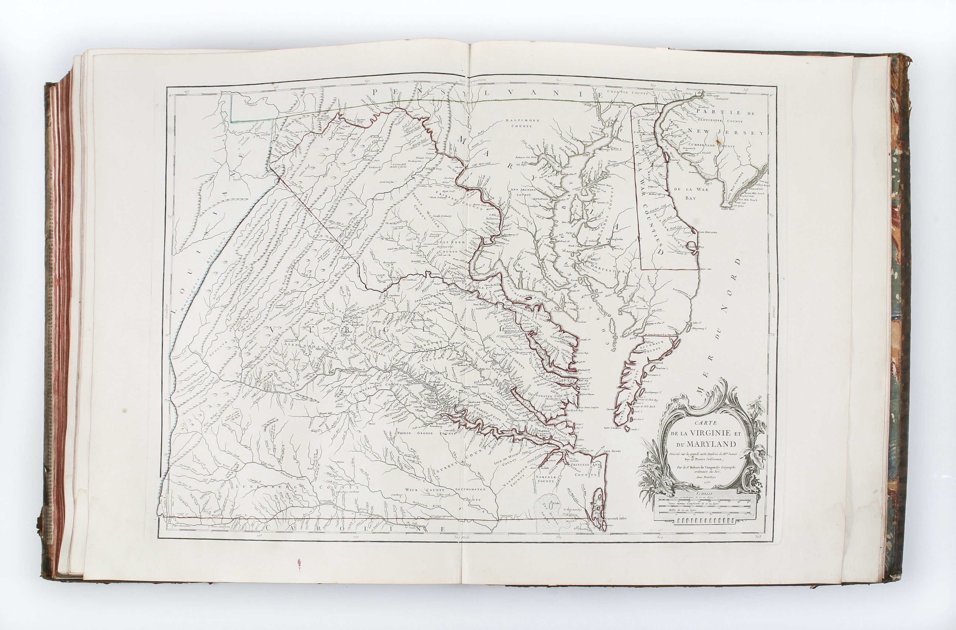
The atlas is interesting as presenting the French view of the geographic boundaries between English and French possessions in North America, just as that rivalry developed into the French and Indian War. One of the notable American maps is the French version of Fry and Jefferson’s map of Virginia, in its first state with the boundaries of Lord Fairfax’s Grant shown.
This is the second issue of the atlas, with five post-road maps added, expanding the contents to 108 maps.
Reference: Shirley, T.ROBV-1c & 1d; Nordenskiöld Collection Catalogue, 245.
Stock Code: 223301


