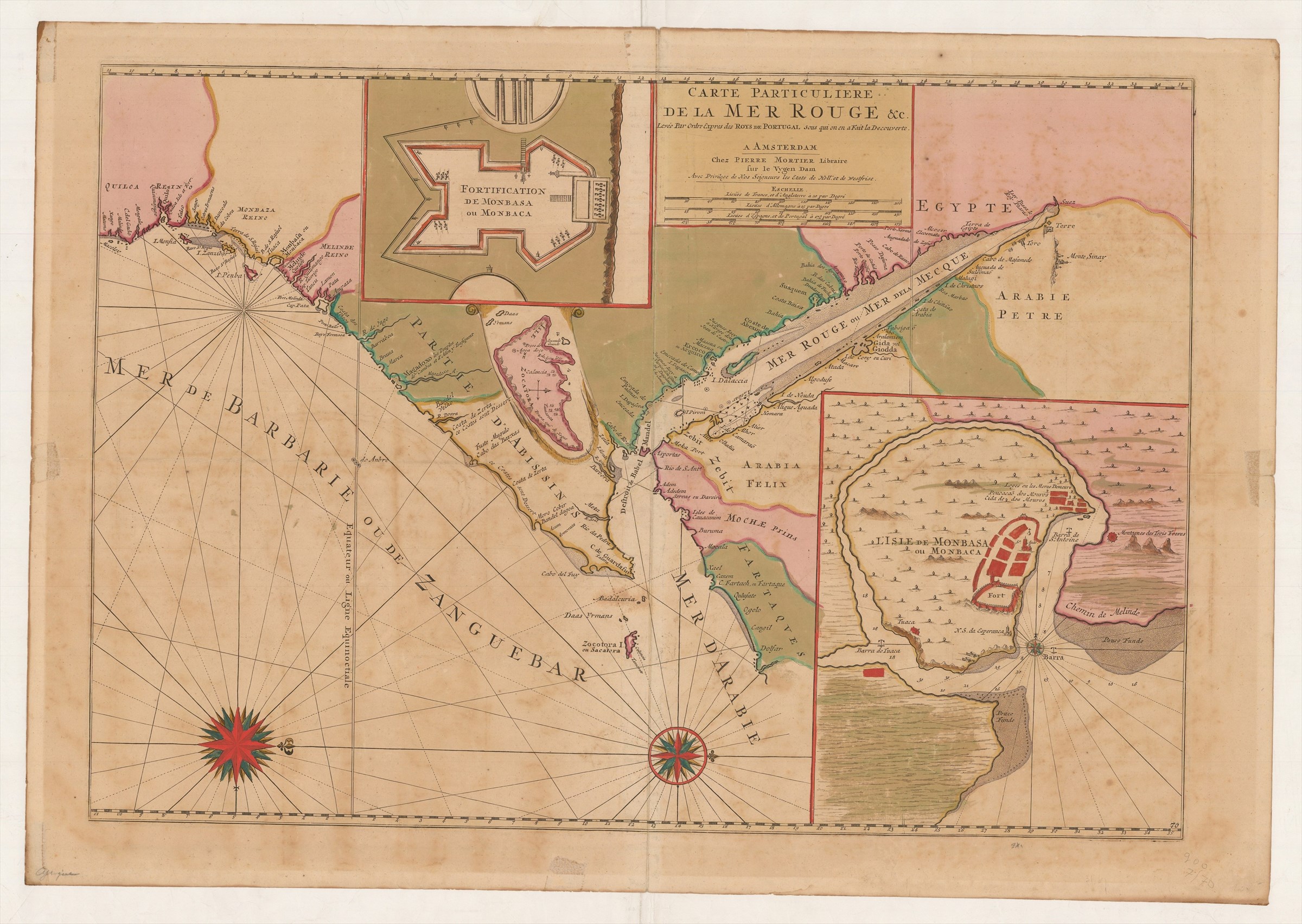
CARTE PARTICULIERE DE LA MER ROUGE ...'
MORTIER Pieter
£800.00
Please contact us in advance if you would like to view this book at our Curzon Street shop.
Large engraved chart, 525 x 760 mm, on two sheets joined, in bright original wash colour, the paper a little browned, with a short tear into the printed area.
From Mortier's Suite du Neptune Francois', a sea-atlas of the world, this chart covers the coast from, Cape Delagado to Dohar in Arabia, with the entire extend of the Red Sea. Three insets depict the marine approach to Mombasa, the fort there and the island of Socotra. The map is constructed from unpublished Portuguese sources.
Stock Code: 222840


