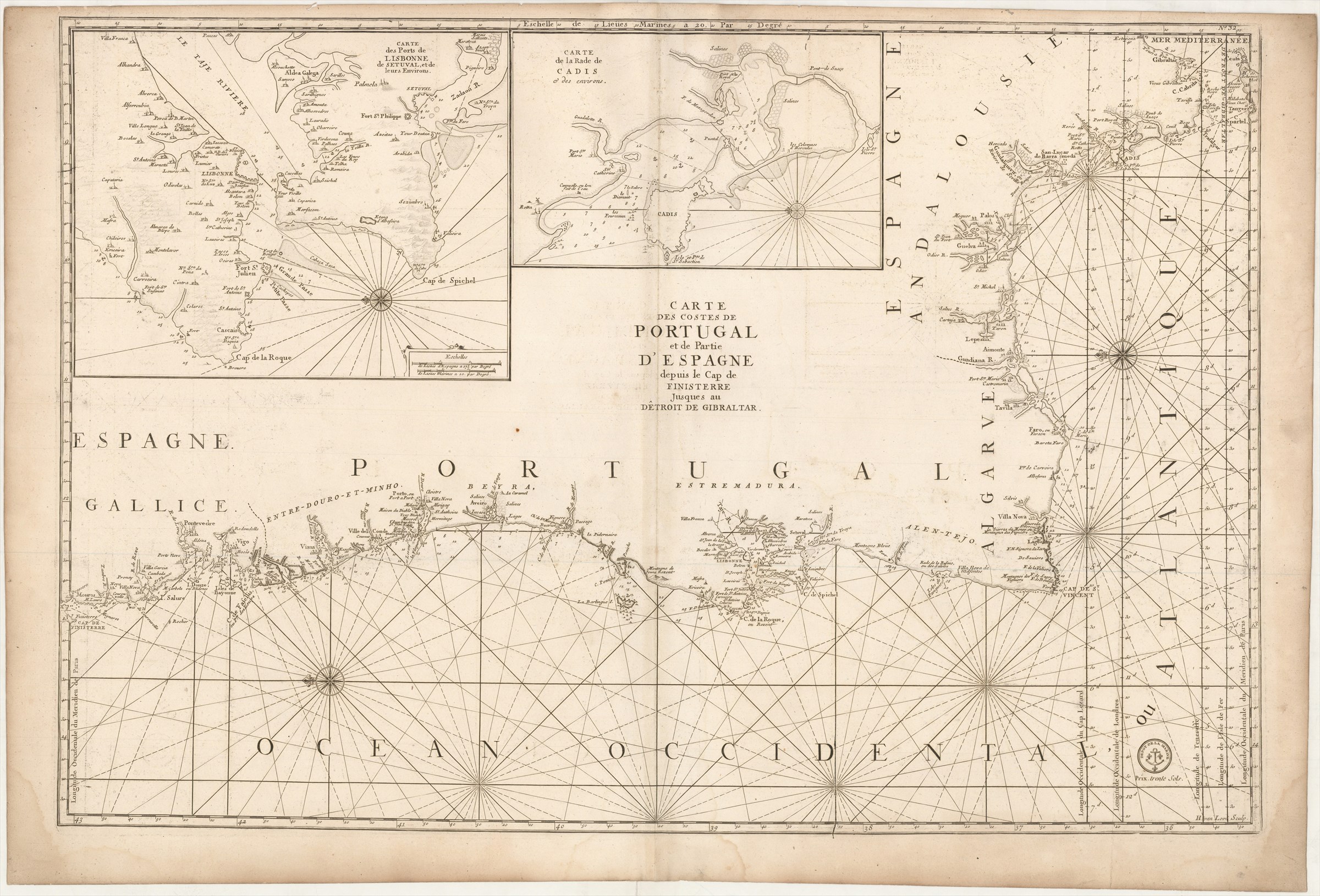
Carte des Costes de Portugal et de Partie d'Espagne depuis le Cap de Finisterre jusques au Dêtroit de Gibraltar.
DÉPÔT DES CARTES ET PLANS DE LA MARINE ([ca. 1760].)
£600.00
Please contact us in advance if you would like to view this book at our Curzon Street shop.
Copperplate engraving, 595 x 880 mm. Paris : Dépôt des Cartes et Plans de la Marine,
From a second edition of the Dépôt des Cartes et Plans de la Marine's Le Neptune François ..., edited by Charles Pene and others, published during the Seven Years' War between Britain and France. For this edition the Dépôt's stamp, with anchor, was inserted, as also a price for when the chart was sold separately.
Pastoureau, Neptune Français, notes and A: the First Edition.
Stock Code: 226219


