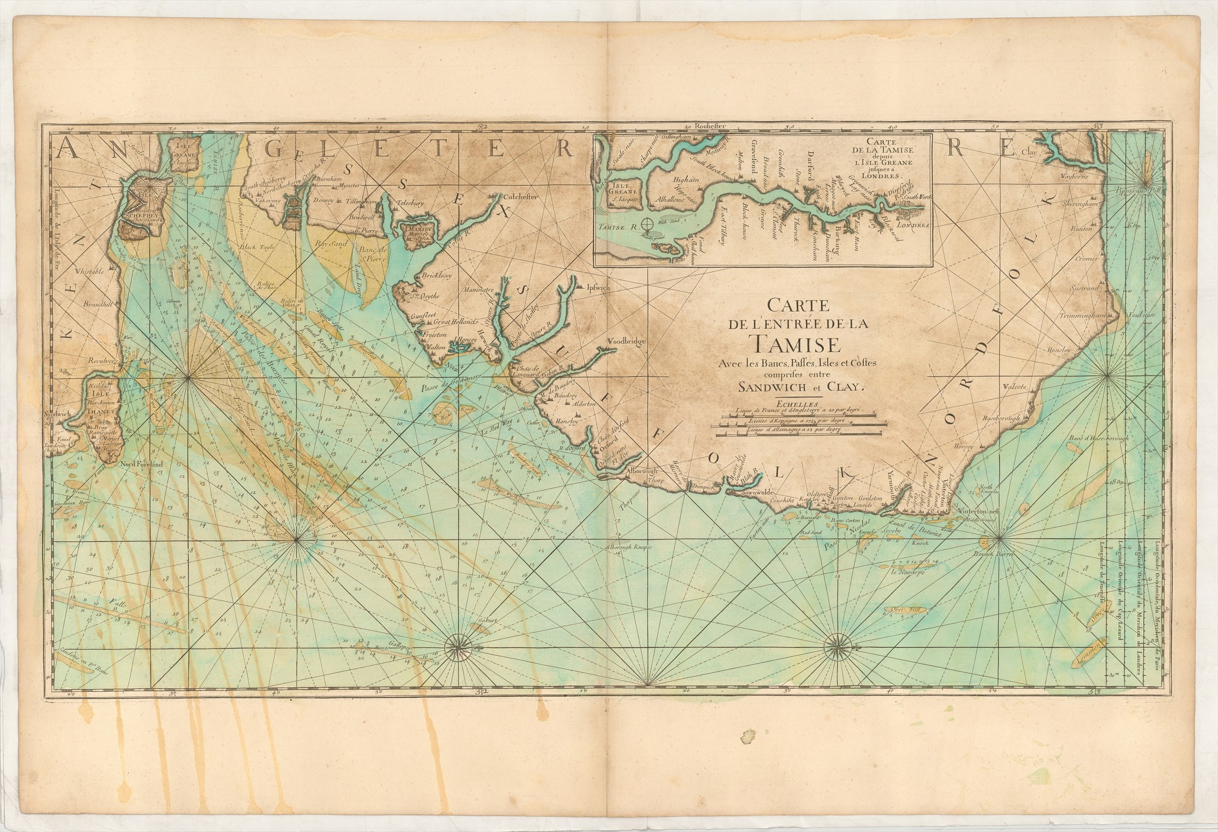
Carte de L'Entrée de la Tamise avec les Bancs, Passes, Isles et Costes Comprises entre Sandwich et Clay.
DÉPÔT DES CARTES ET PLANS DE LA MARINE ([ca. 1750].)
£500.00
Please contact us in advance if you would like to view this book at our Curzon Street shop.
Copperplate engraving, 455 x 895 mm, with old green wash colour for the sea and brown for the land area. Paris : Imprimerie Royale, 1693
From the Dépôt des Cartes et Plans de la Marine's Le Neptune François ou recueil des cartes marines levées et gravées par ordre duy Roy ..., edited by Charles Pene and others. This chart is from the original French edition, and should not be confused with the Jaillot/Mortier contrefaçon published in Amsterdam in the same year.
First Edition, but a late printing of it.
Pastoureau, Neptune Français, A.
Stock Code: 226158


