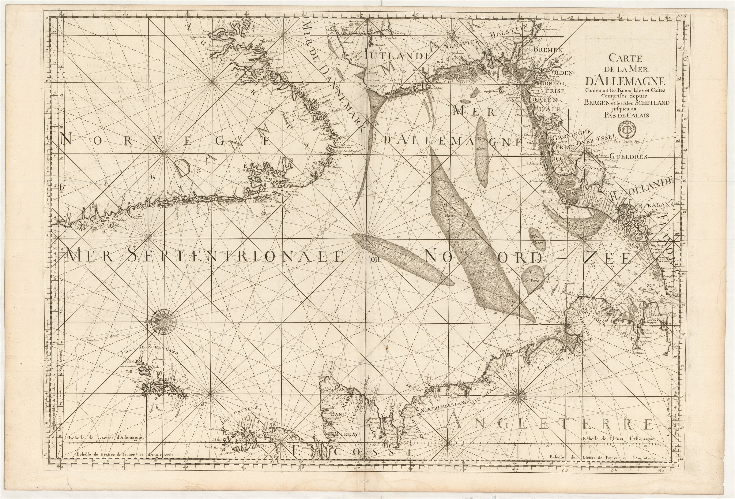
Carte de la Mer d'Allemagne contenant les Bancs Isles et Costes comprises depuis Bergen et les Isles Schetland jusques au Pas de Calais.
DÉPÔT DES CARTES ET PLANS DE LA MARINE ([ca. 1760].)
£500.00
Please contact us in advance if you would like to view this book at our Curzon Street shop.
Copperplate engraving, 605 x 855 mm, with old green wash colour for the sea. Paris : Dépôt des Cartes et Plans de la Marine,
From a second edition of the Dépôt des Cartes et Plans de la Marine's Le Neptune François ..., edited by Charles Pene and others, published during the Seven Years' War between Britain and France. For this edition the Dépôt's stamp, with anchor, was inserted, as also a price for when the chart was sold separately
Pastoureau, Neptune Français, notes and A: the First Edition.
Stock Code: 226207


