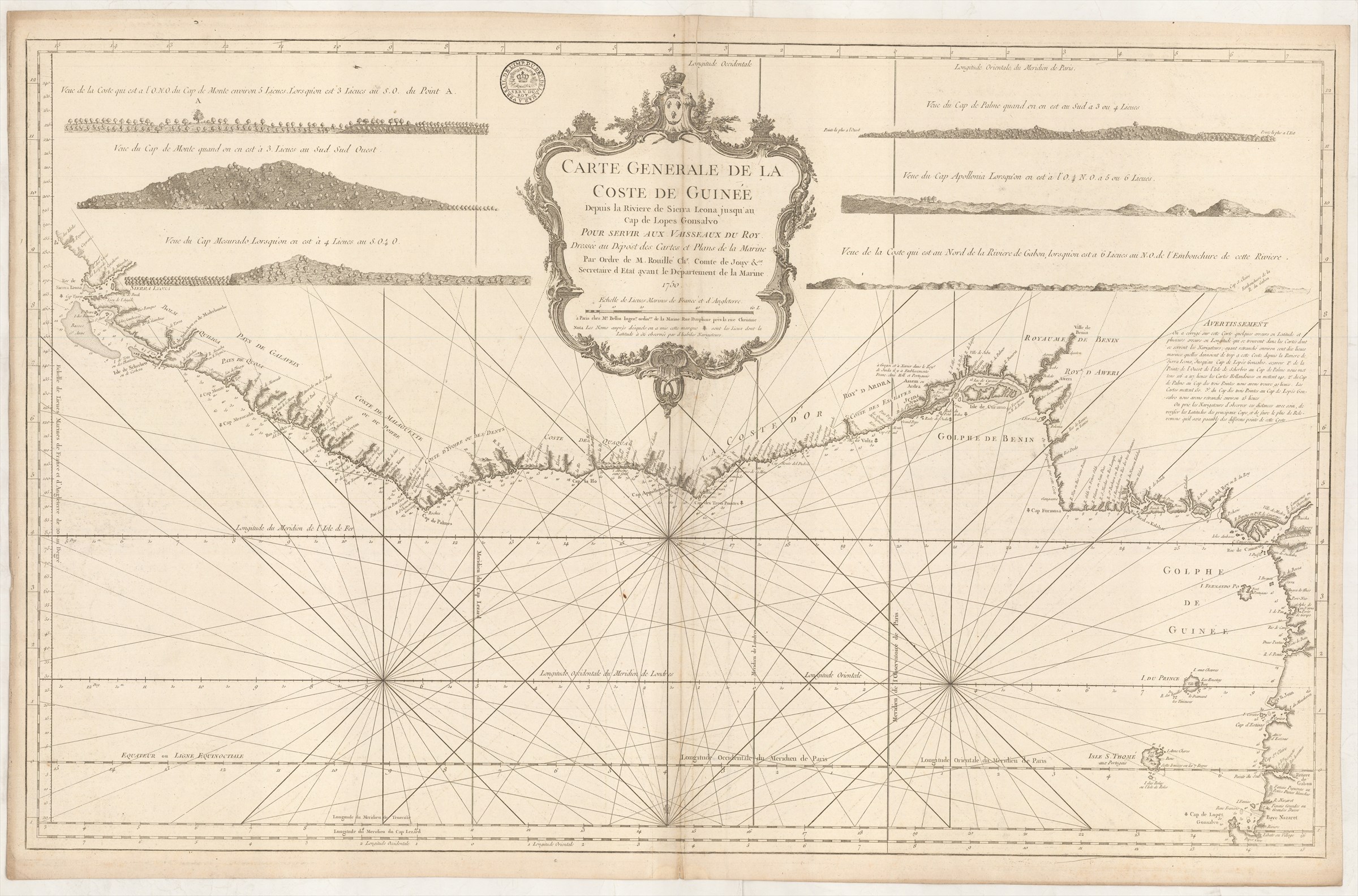
Carte Generale de la Coste de Guinée depuis la Riviere de Sierra Leona jusqu'au Cap de Lopes Gonsalvo pour servir aux vaisseaux du Roy ... 1750.
BELLIN Jacques-Nicolas (1750 )
£400.00
Please contact us in advance if you would like to view this book at our Curzon Street shop.
Large double-page engraved chart, 550 x 880 mm. [Paris : Depot des Cartes et Plans de la Marine]
Jacques-Nicolas Bellin was the leading French chartmaker and publisher of his generation. Employed at the Depot des Cartes et Plans de la Marine (French Admiralty's Hydrographic Office), he was responsible for a huge output of charts for the use of the French Navy, while also using the materials assembled there to prepare maps to illustrate important histories and geographies of North America, Japan, Paraguay and Saint Domingo, for l'abbé Prevost's Histoire Générale des Voyages ... and his own Petit Atlas Maritime, as well as numbers of separately published maps of Canada.
This fine chart covers the southern coast of West Africa from Sierra Leone to Cape Lopes Gonsalvo, just south of the Equator. In the hinterland are placed six coastal recognition profiles, designed to assist mariners to determine their position by identifying landmarks along the coast. There is also a panel of text with brief editorial comments on the construction of the chart.
This is an early printing of the chart, with an inked stamp, 'De L'Imp[rimerie]. du Dep[ot]. de la Mar[in]e. a Versail[les].' Later printing have the Depot stamp engraved on the plate.
Stock Code: 222980


