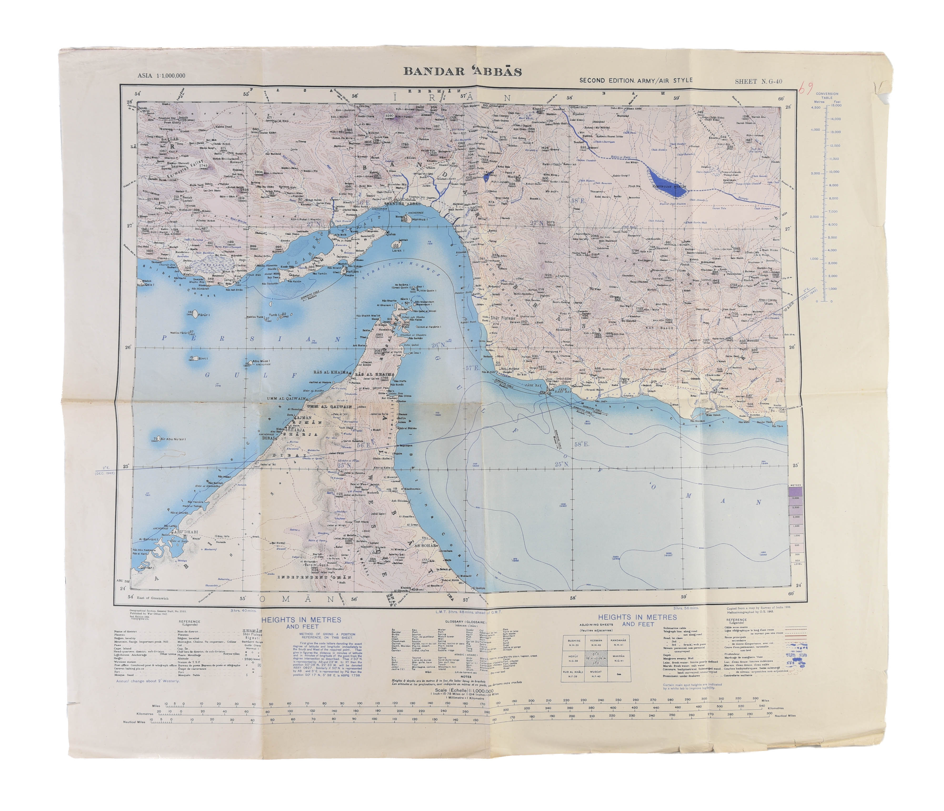
Bandar 'Abbas.
ARABIAN GULF. ; GEOGRAPHICAL SECTION, GENERAL STAFF (1943.)
£600.00
Please contact us in advance if you would like to view this book at our Curzon Street shop.
Air chart of the most important strategic point in the Gulf
Second edition. Geographical Section, General Staff, No. 2555. Colour heliozincographed map, measuring 800 by 630mm. Old folds, some dents and creases, several small tears to margins, some light spotting, otherwise near very good. Scale 1:1,000,000. [London], War Office,
An excellent official British aeronautical chart of the Strait of Hormuz, covering part of Oman, a large section of the coastline of the United Arab Emirates (including Abu Dhabi, Dubai, Sharjah and Ras al Khaimah) and Hormuz Island.
It was issued by the Geographical Section, General Staff (GSGS) during the Second World War as part of their 2555 series of 1:1,000,000 scale maps. The GSGS supplied maps to the British Armed Forces (in this case the R.A.F.), collected data on foreign survey networks and prepared survey data for Expeditionary Force mobilisation.
Stock Code: 251630


