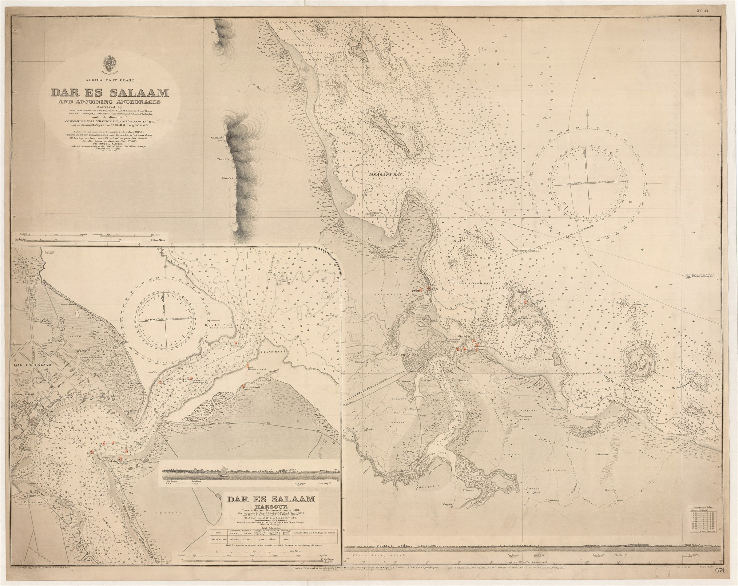
Africa - East Coast. Dar es Salaam and adjoining Anchorages. Surveyed ... 1874.
ADMIRALTY (1933.)
£250.00
Please contact us in advance if you would like to view this book at our Curzon Street shop.
Double-page engraved chart, 665 x 850 mm, some features highlighted in colour. Lightly soiled in the upper margin. With the library stamp of the Royal Commonwealth Society.
Extremely detailed chart of the maritime approaches to Dar Es Salaam. The chart was engraved and published first in 1875 and successively updated, notably as a result of a German surveys in 1911, which supplied the information for the inset of Dar Es Salaam Harbour, with some detail of the town along the harbour front.
Stock Code: 240754


