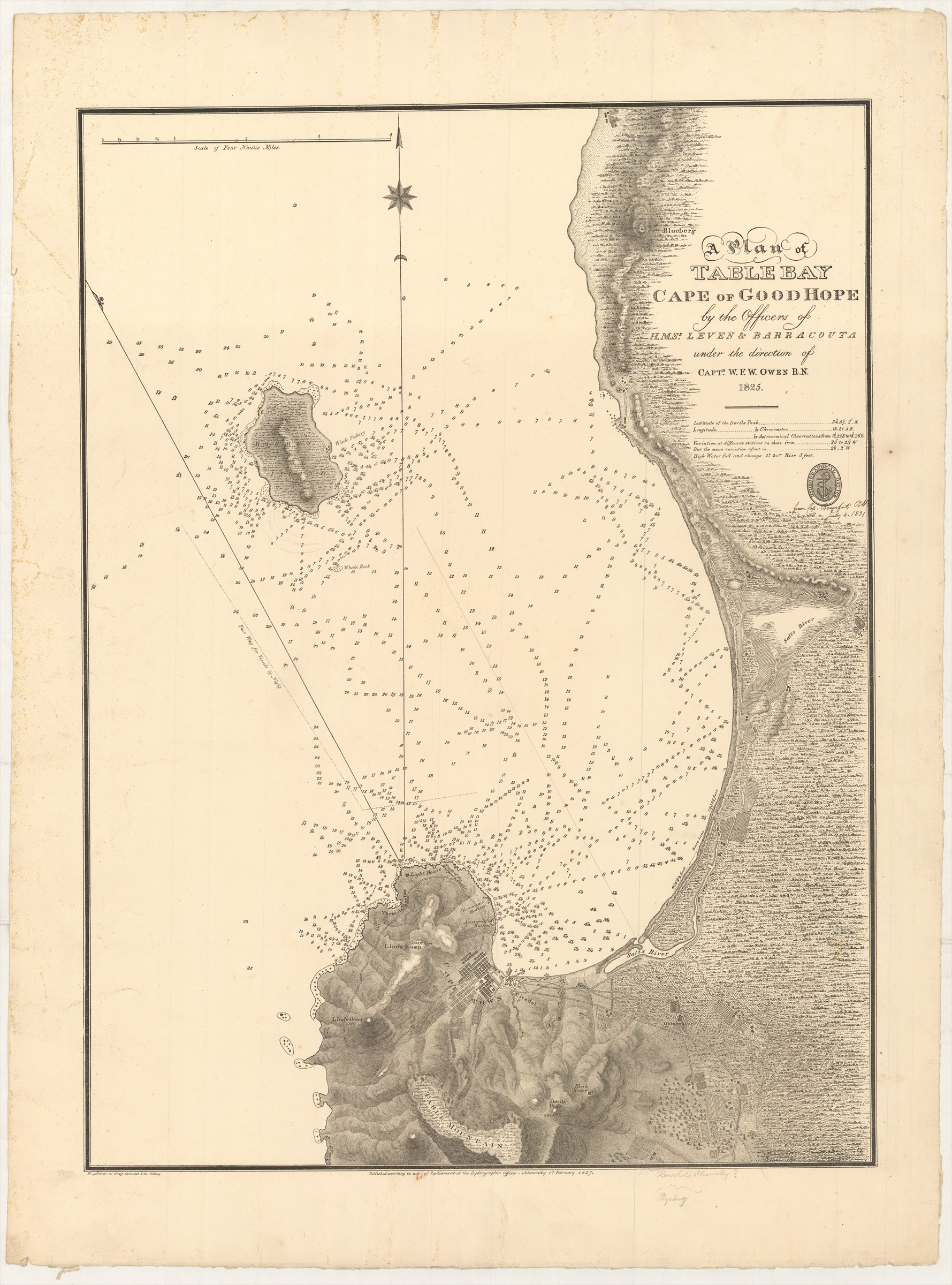
A Plan of Table Bay, Cape of Good Hope, by the Officers of H.M. Ships Leven and Barracouta, under the direction of Capt. W.F.W. Owen R.N., 1825.
ADMIRALTY HYDROGRAPHIC OFFICE (1827.)
£1500.00
Please contact us in advance if you would like to view this book at our Curzon Street shop.
Lithograph, 575 x 425 mm. The paper watermarked 'JWhatman Turkey Mill 1826'. London : Admiralty Hydrographic Office, 1st February,
Very early Admiralty chart, a detailed depiction of Table Bay with Cape Town. Unusually, this is a lithograph, produced by the partnership of Engelman, Graf and Coindet.
Annotated in manuscript 'from Capt. Beaufort [illegible] July 4, 1831'.
A further manuscript note, against a building near the lower border reads 'Herschel's Observatory?', perhaps the building used by Herschel during his important stay in Cape Town in the 1830s. The official Observatory is marked to the north of this building.
Stock Code: 226304


