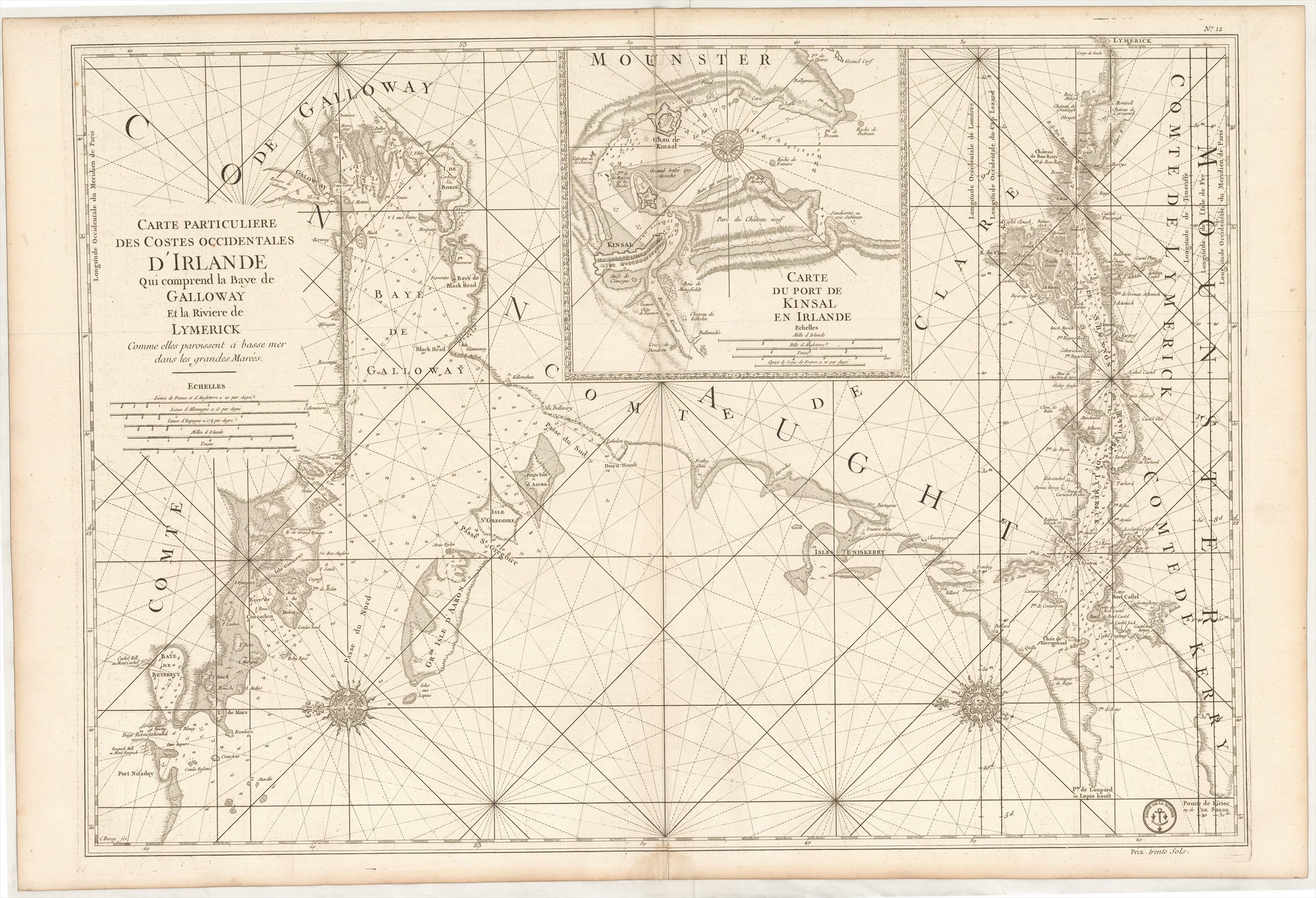
Carte Particuliere des Costes Occidentales d'Irlande qui comprend la Baye de Galloway et la Riviere de Lymerick commes elles paroissent a basse mer dans les grandes Marées.
DÉPÔT DES CARTES ET PLANS DE LA MARINE ([ca. 1760].)
£500.00
Please contact us in advance if you would like to view this book at our Curzon Street shop.
Copperplate engraving, 600 x 860 mm. Paris : Dépôt des Cartes et Plans de la Marine,
From a second edition of the Dépôt des Cartes et Plans de la Marine's Le Neptune François ..., edited by Charles Pene and others, published during the Seven Years' War between Britain and France. For this edition the Dépôt's stamp, with anchor, was inserted, as also a price for when the chart was sold separately.
With an inset of the River Dee upstream beyond Chester to Holt.
Pastoureau, Neptune Français, notes and A: the First Edition.
Stock Code: 226213


