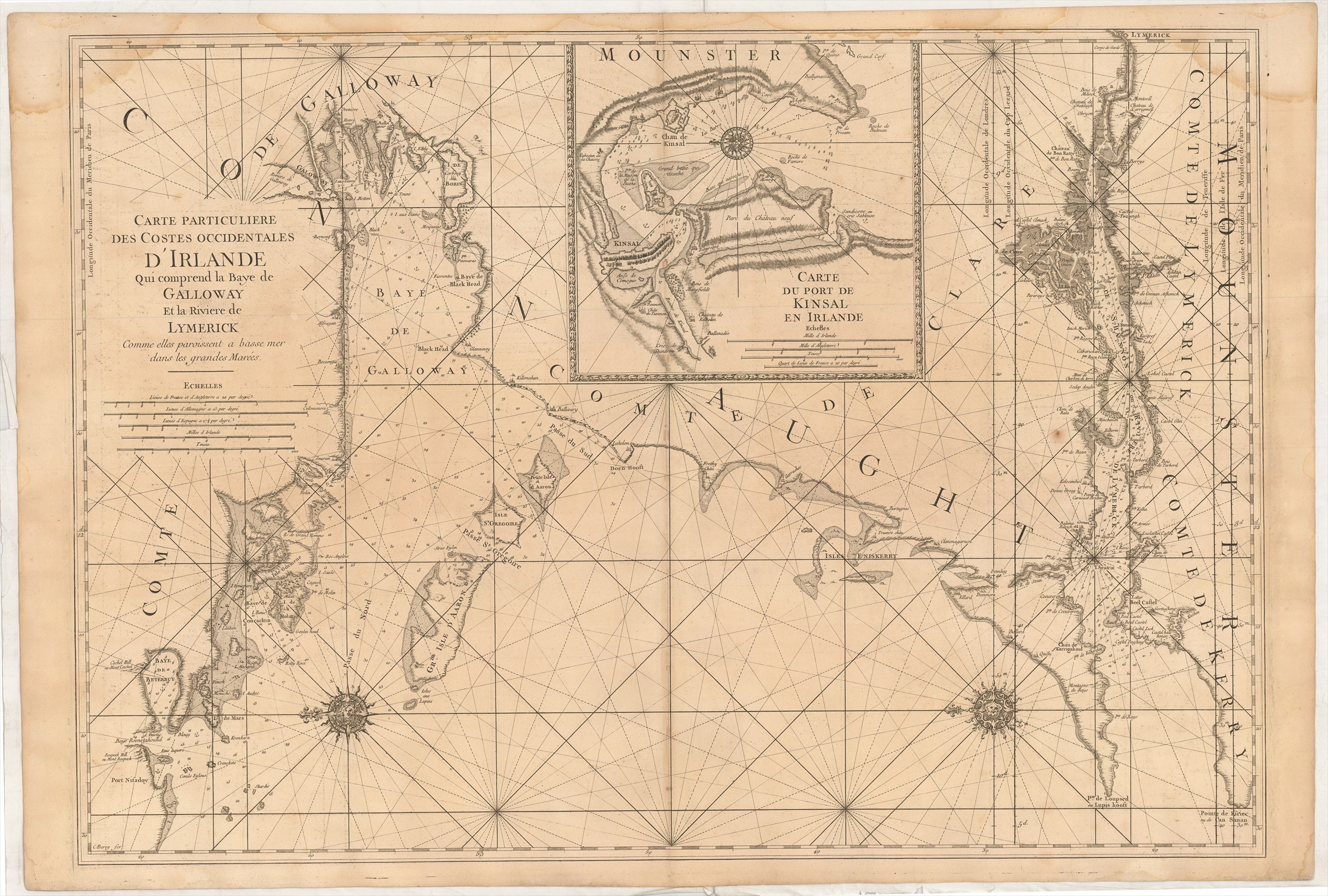
Carte Particuliere des Costes Occidentales d'Irlande qui comprend la Baye de Galloway et la Riviere de Lymerick commes elles paroissent a basse mer dans les grandes Marées.
DÉPÔT DES CARTES ET PLANS DE LA MARINE ([ca. 1750].)
£500.00
Please contact us in advance if you would like to view this book at our Curzon Street shop.
Copperplate engraving, 600 x 860 mm. Paris : Imprimerie Royale, 1693
From the Dépôt des Cartes et Plans de la Marine's Le Neptune François ou recueil des cartes marines levées et gravées par ordre duy Roy ..., edited by Charles Pene and others. This chart is from the original French edition, and should not be confused with the Jaillot/Mortier contrefaçon published in Amsterdam in the same year.
With an inset of the River Dee upstream beyond Chester to Holt.
First Edition, but a late printing of it.
Pastoureau, Neptune Français, A.
Stock Code: 226161


