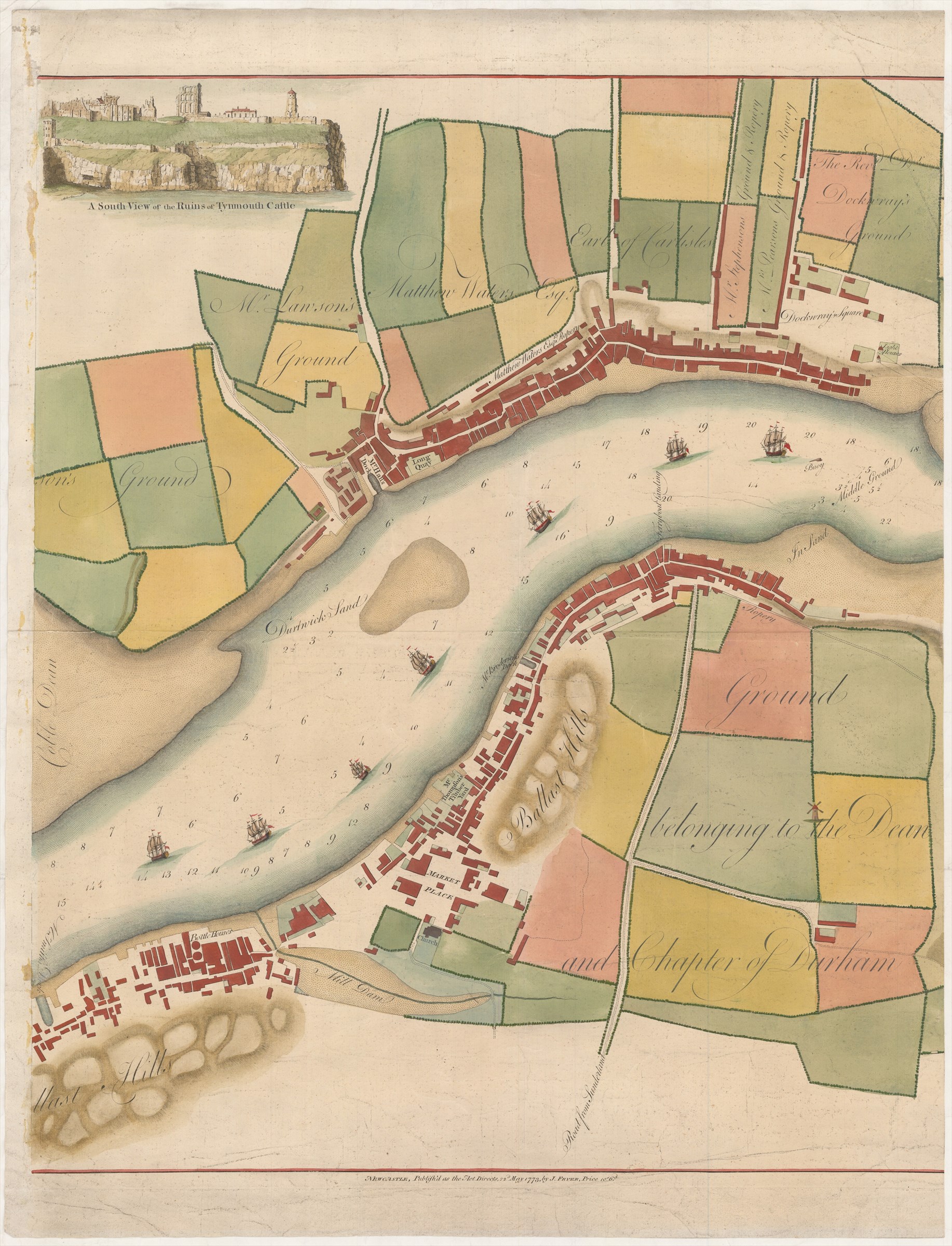
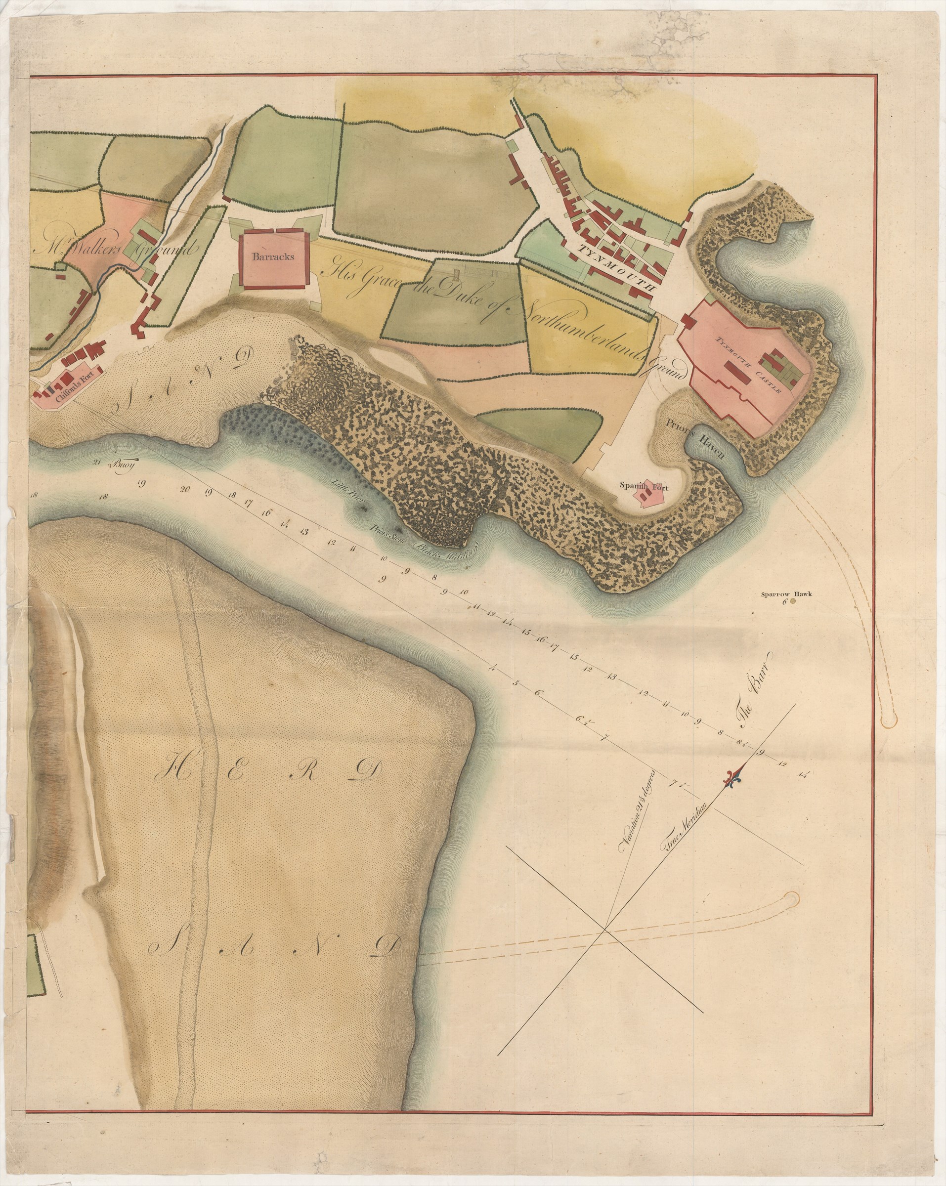
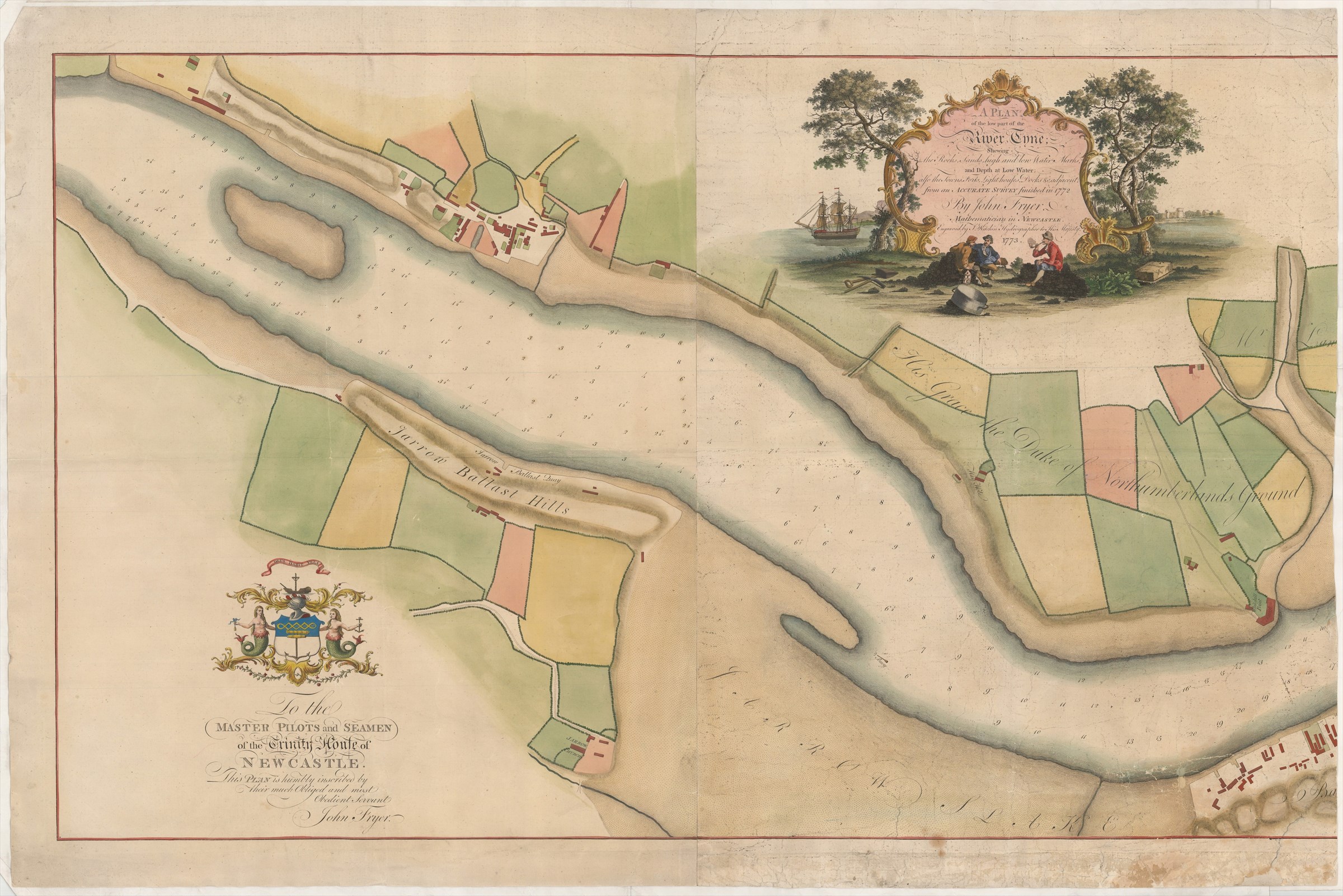
A Plan of the low part of the River Tyne; shewing the Rocks, Sands, high and low Water Marks and Depth at Low Water; also the Towns, Forts, Light houses, Docks &c. adjacent; from an Accurate Survey finished in 1772 ...
FRYER John (1773.)
£2000.00
Please contact us in advance if you would like to view this book at our Curzon Street shop.
Copper engraving, in later hand colour, on four sheets, once joined, now separated into three sections, the left and centre left sheets still joined. Left and centre left sheets together: 627 x 1024 mm; centre right sheet: 636 x 521 mm and right sheet: 632 x 513 mm. The sheets previously folded, with some holes repaired and crumpling of the margins. Newcastle-upon-Tyne : John Fryer, 22d. May,
Rare chart of the lower part of the River Tyne, from upstream of Jarrow to the sea, with South Shields and Tynmouth prominent.
There is an inset 'A South View of the Ruins of Tynmouth Castle.'
This chart is unrecorded on COPAC.
Stock Code: 225958


