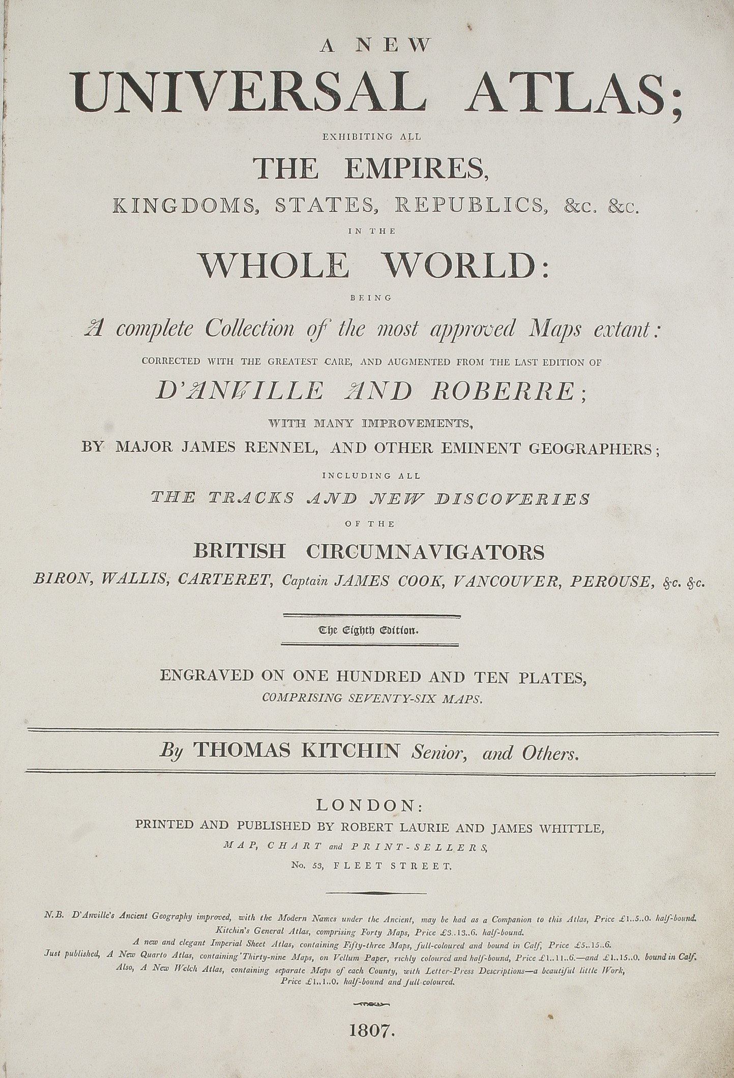
A New Universal Atlas; exhibiting all the Empires, Kingdoms, States, Republics, &c. &c. in the whole world: being a complete collection of the most approved maps extant: corrected with the greatest care, and augmented from the last edition of d'Anville and Roberre: with many improvements, by Major James Rennel, and other eminent geographers; including all the tracks and new discoveries of the British circumnavigators Biron, Wallis, Carteret, Captain James Cook, Vancouver, Perouse, &c. &c. ...
SAYER Robert (1807.)
£20000.00

Please contact us in advance if you would like to view this book at our Curzon Street shop.
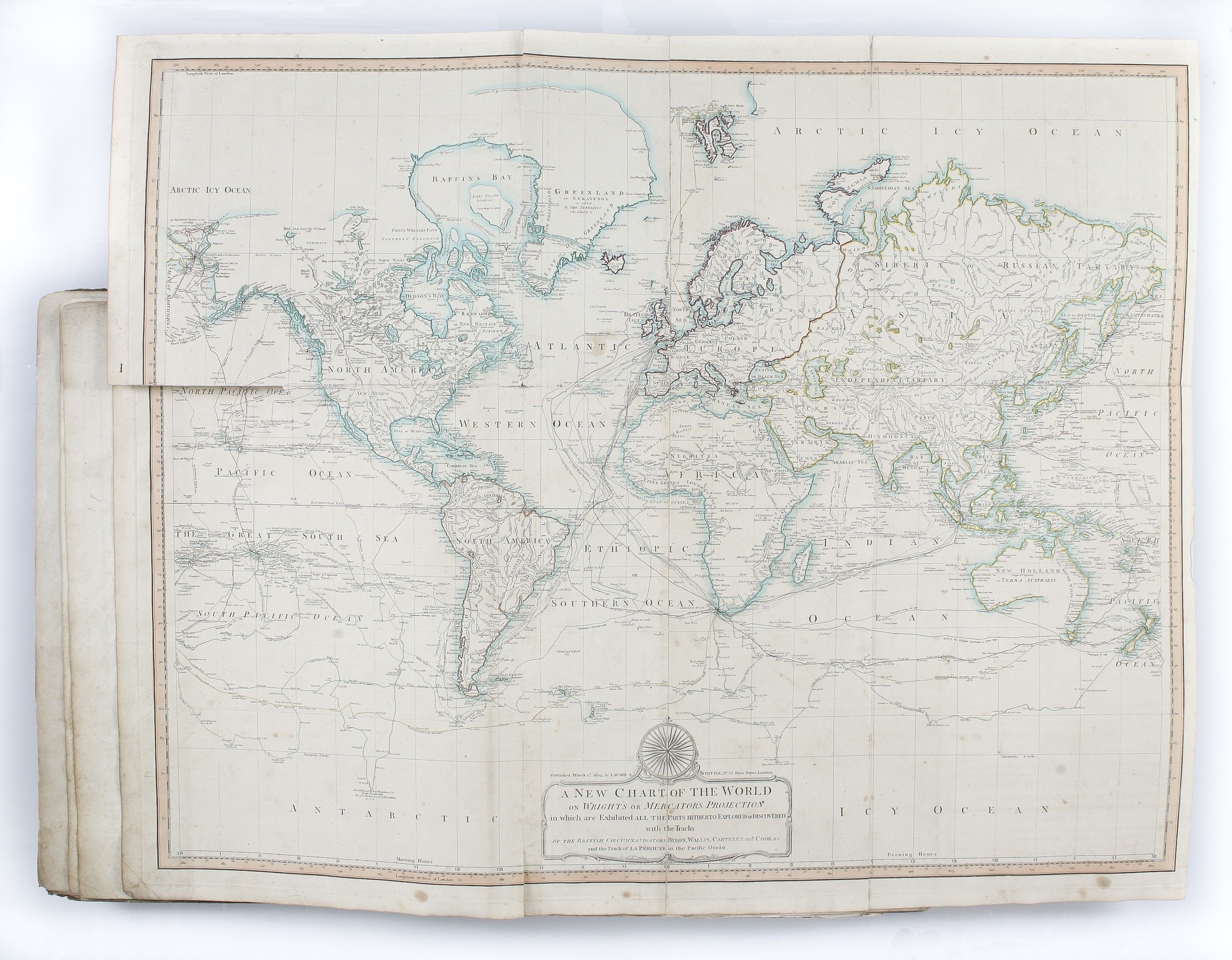
Eighth edition [sic]; large folio (545 x 398 mm); letterpress title-page; index leaf calling for seventy-six map-sections, totalling sixty maps, fourteen on four sheets joined as two, the Asia now on six sheets joined as three. The map of the Southern States is lacking. Some separation of folds from handling (as usual). Recent half calf with marbled paper-covered boards, six raised bands and red morocco label with gilt lettering to spine. London : Robert Laurie & James Whittle,
Unrecorded edition of The General Atlas, first published by Robert Sayer in 1773, here re-printed by his successors Robert Laurie and James Whittle in 1807. The atlas was the best English world atlas of the period, and was reprinted on a near annual basis.
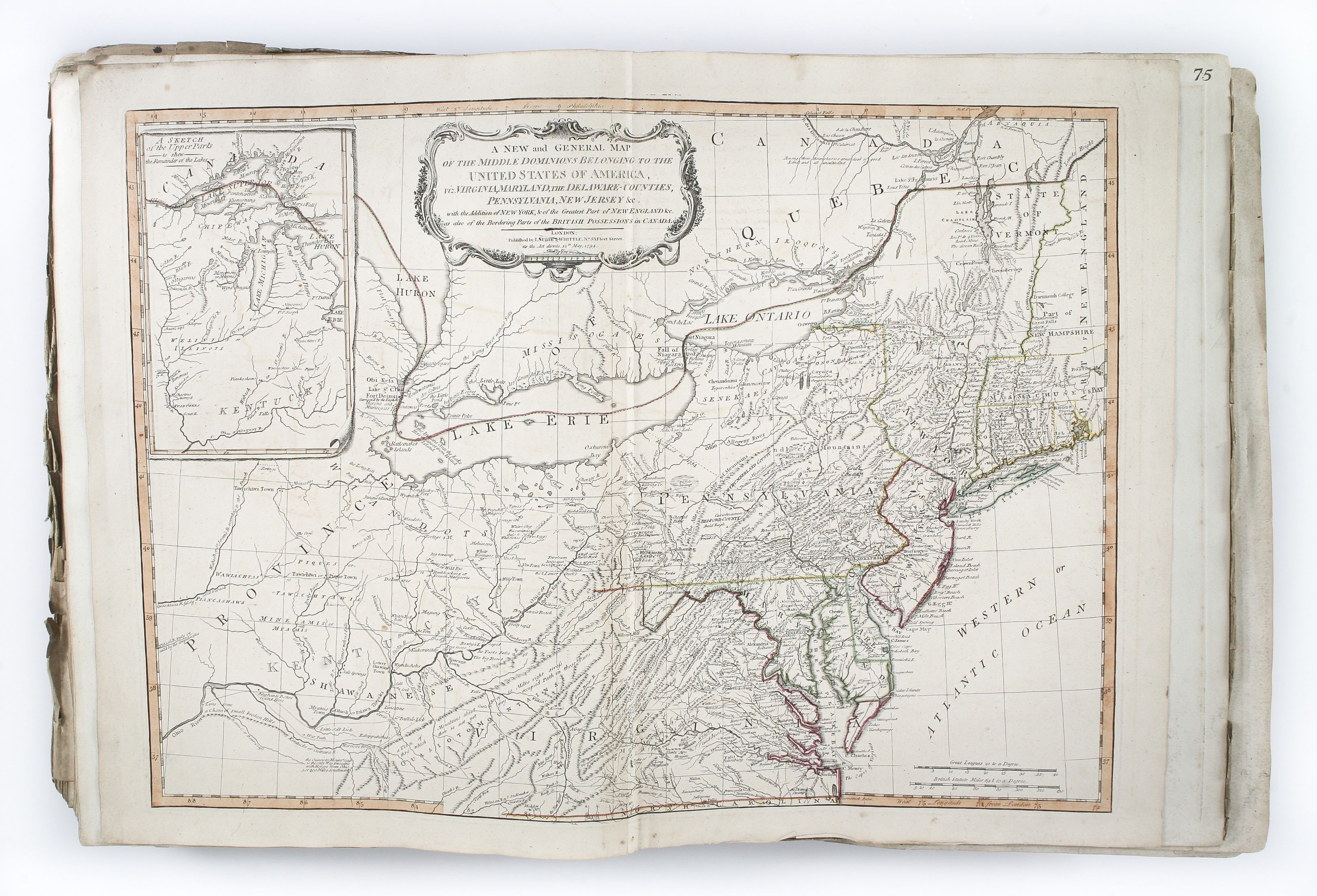
The principal change made by Laurie and Whittle was to add their imprint, dated 12th May 1794, to the existing plates, sometimes adding new title cartouches and, more infrequently, making geographical changes.
The partners also expanded the geographic coverage adding, inter-alia, maps of the Mediterranean islands Minorca, Sicily and Corsica, regional maps of Germany, maps of Arabia, Persia, China, Japan, and a series of maps of India and its provinces, based on the surveys of James Rennell.
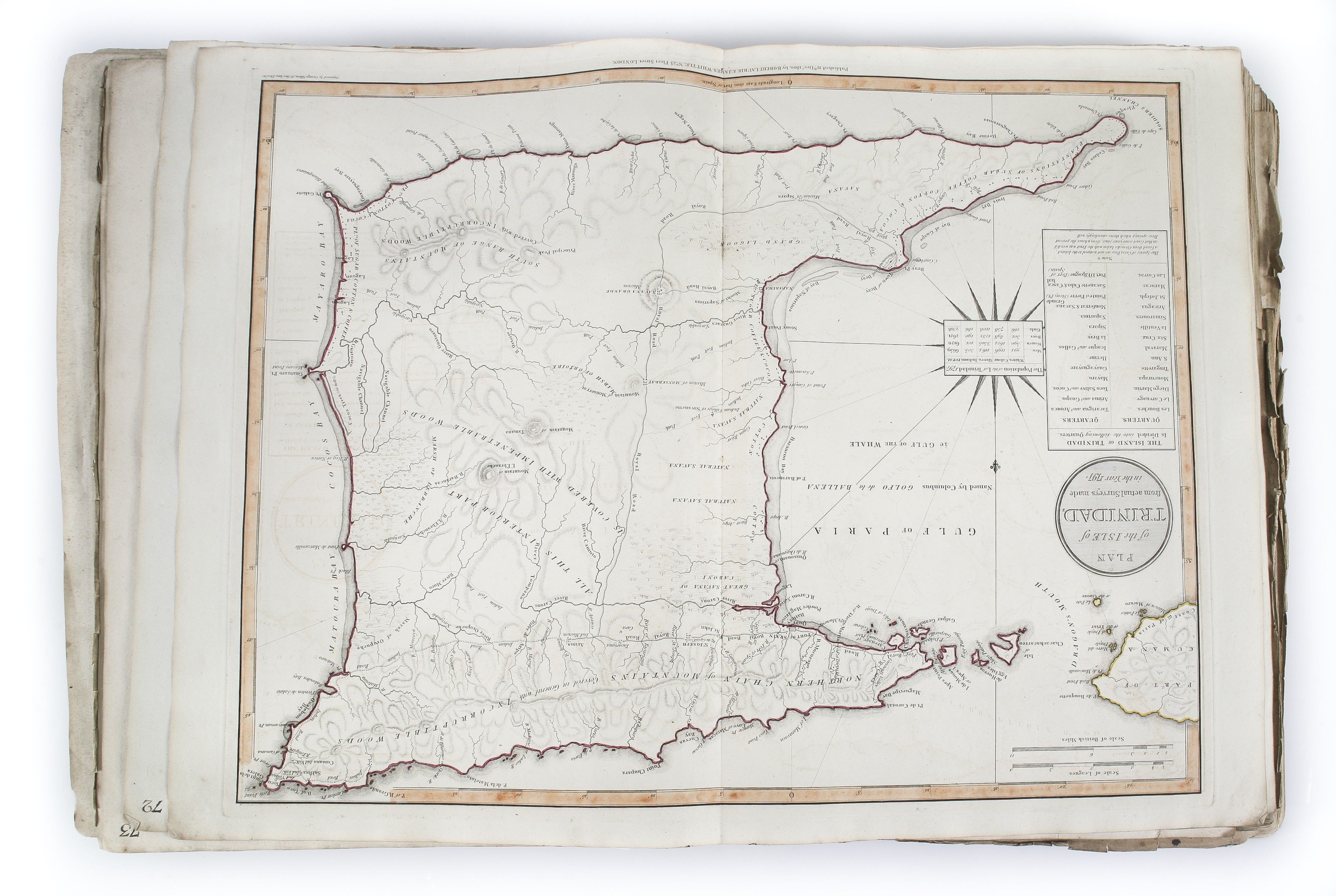
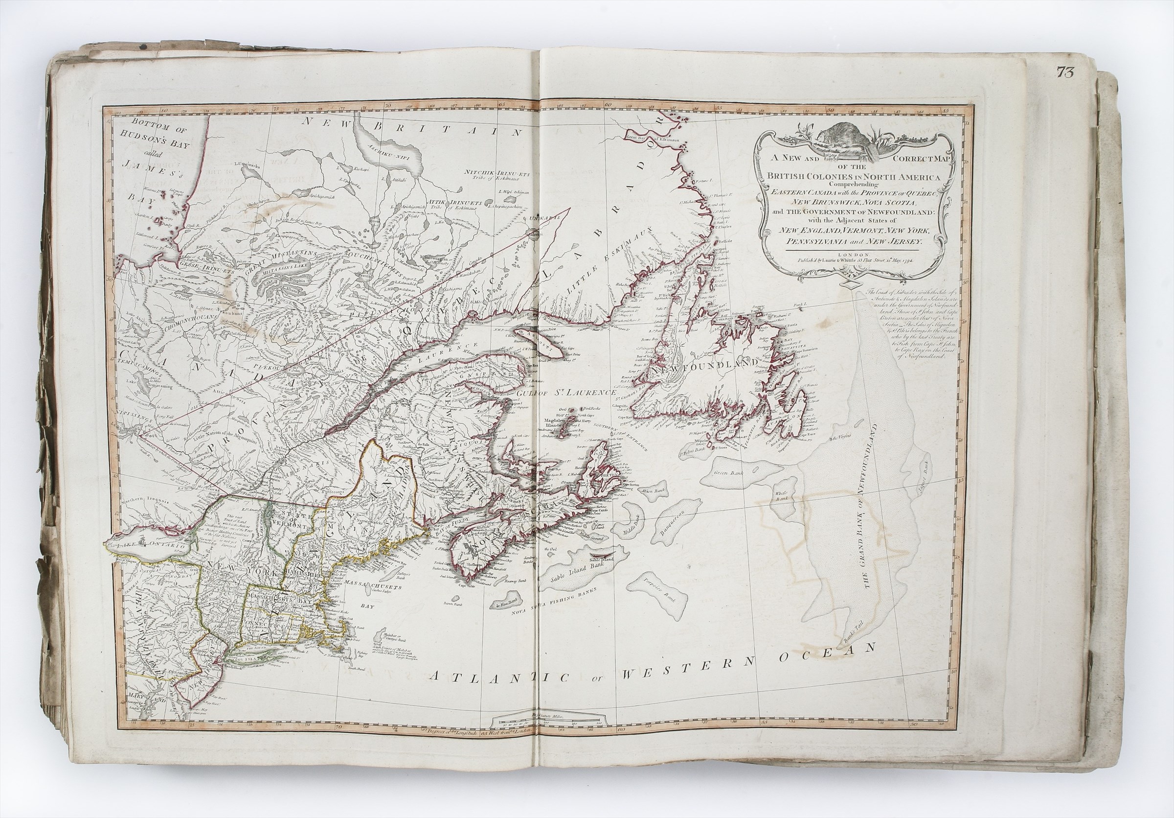
This copy of the atlas includes a number of important or scarce Laurie and Whittle maps: the wall-map of the Netherlands on four sheets, with attractive vignette battle scene, the map of northern France (1802), Enouy’s post road map of central Europe, West Africa, Egypt, Trinidad and their maps of the Northern and Middle States of the United States (the Southern States lacking).
The wall-map of Asia has the two additional sheets which extend the coverage south to include all of Australia, these described by Shirley (Vol. II: 47) without realizing their connection to the Asia map.
Reference: cf. Shirley, T.LAU.1c: the 1799 edition.
Stock Code: 223225


