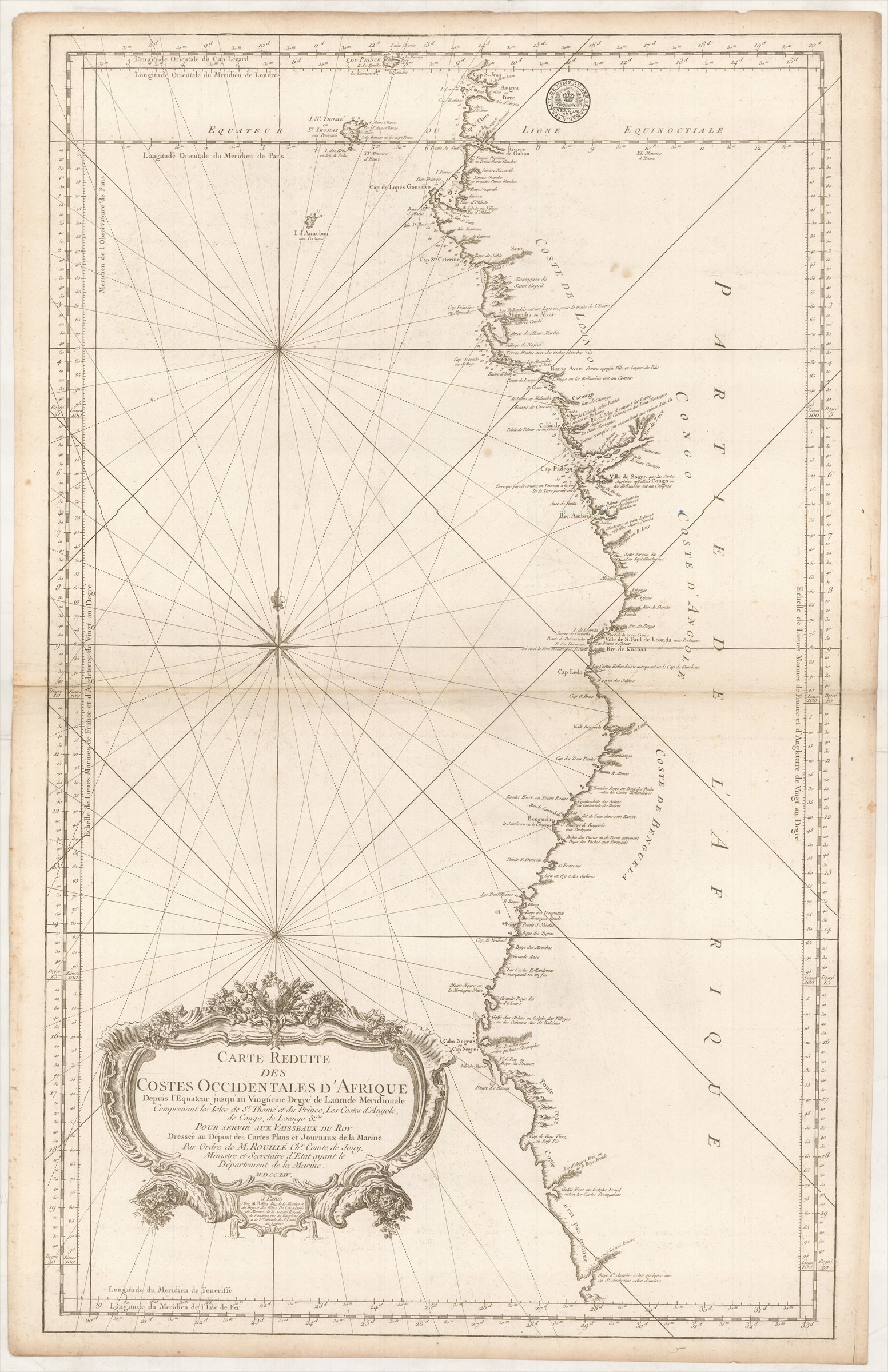
Carte Reduite des Costes Occidentales d'Afrique depuis l'Equateur jusqu'au Vingtieme Degré de Latitude Meridionale comprenantles Isles de St. Thomé et du Prince, Les Costes d'Angole, de Congo, de Loango &ca. ... M.D.CC.LIV.
BELLIN Jacques-Nicolas (1754)
£350.00
Please contact us in advance if you would like to view this book at our Curzon Street shop.
Large double-page copper engraved chart, 895 x 550 mm. Paris : [Depot des Cartes et Plans de la Marine],
Jacques-Nicolas Bellin was the leading French chartmaker and publisher of his generation. Employed at the Depot des Cartes et Plans de la Marine (French Admiralty's Hydrographic Office), he was responsible for a huge output of charts for the use of the French Navy, while also using the materials assembled there to prepare maps to illustrate important histories and geographies of North America, Japan, Paraguay and Saint Domingo, for l'abbé Prevost's 'Histoire Générale des Voyages ...' and his own 'Petit Atlas Maritime', as well as numbers of separately published maps of Canada.
This fine chart covers the south-western coast of Africa broadly from the Equator south to 'Baye S.t Antoine', that region labelled 'Coste n'est pas connue' (Coast not known).
This is the best printed chart of the region of its day, here in an early printing, with an inked stamp, 'De L'Imp[rimerie]. du Dep[ot]. de la Mar[in]e. a Versail[les].' Later printing have the Depot stamp engraved on the plate.
Stock Code: 222981


