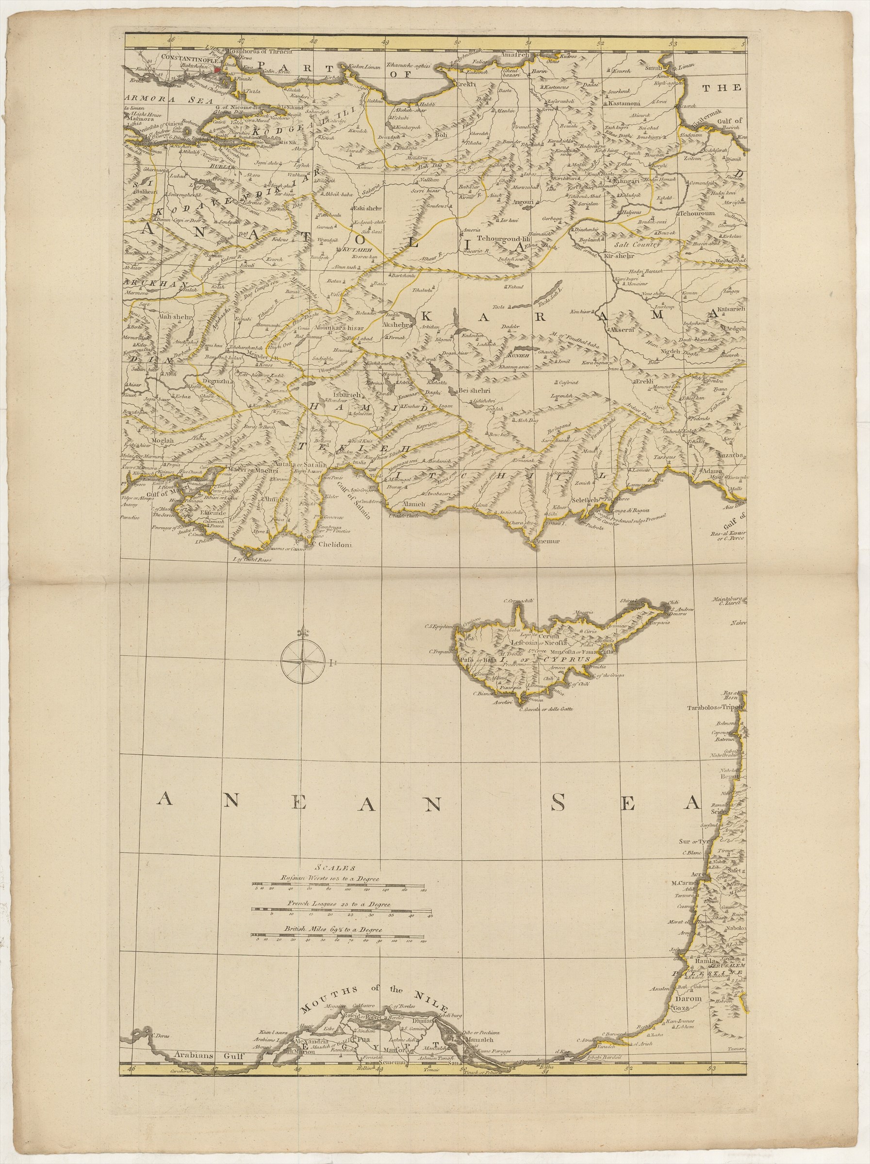
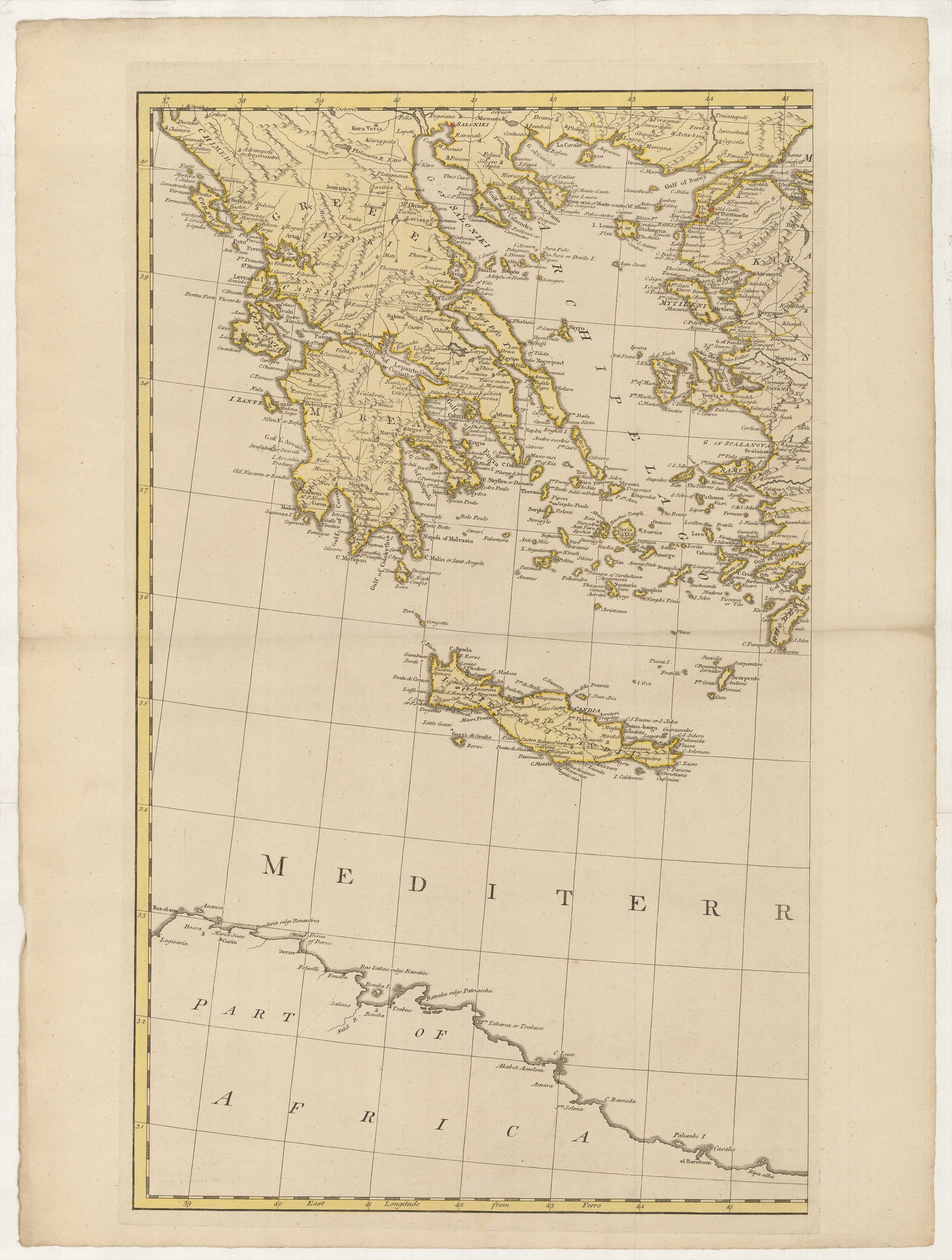
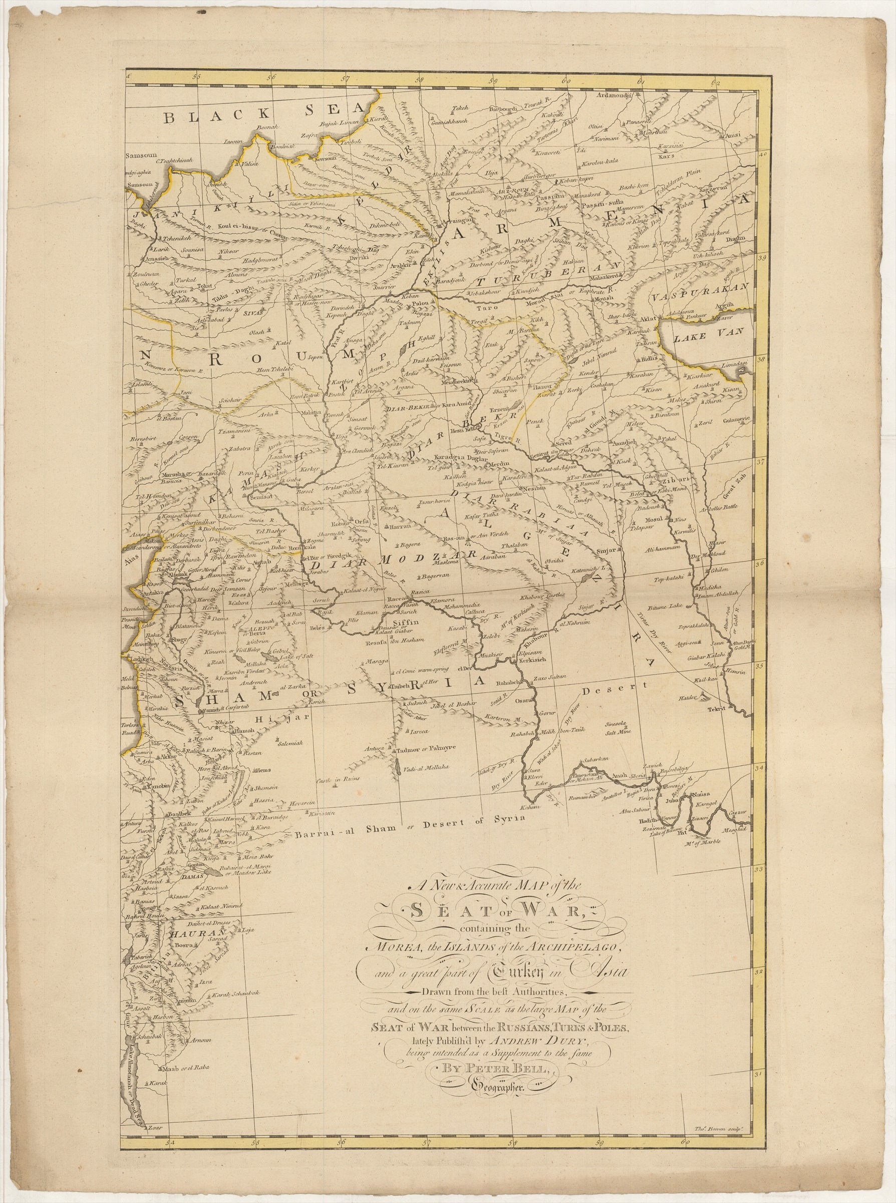
A New & Accurate Map of the Seat of War, containing the Morea, the Islands of the Archipelago, and a great part of Turkey in Asia Drawn from the best Authorities, and on the same Scale as the large Map of the Seat Of War between the Russians, Turks & Poles, lately Publish'd by Andrew Dury, being intended as a Supplement to the same, by Peter Bell, Geographer.
BELL Andrew ([ca. 1770].)
£3000.00
Please contact us in advance if you would like to view this book at our Curzon Street shop.
Wall-map on three uncut sheets, each approximately 700 x 425 mm, in fine original colour. London : Andrew Dury,
In 1769, Dury published Peter Bell's four-sheet map of the Black Sea region to depict the theatre of war between the Russians and Turks. Subsequently Bell drew this three-sheet map of the eastern Mediterranean, which extends from Corfu in the west to the Levant Coast and on to the Tigris River.
Both in intent and extent, the map was designed as a supplement to the four-sheet map, extending the geographical coverage southwards to the North African littoral. It could be sold separately (as here), but it was also designed so that it could be cut and joined to the larger map to make one complete wall-map of south-eastern Europe and the Near East. When found thus, it is in company with the 1770 state of the four-sheet map, hence the date assigned here.
The map is rare in any form. The only institutional location for the three sheets traced is in the British Library's King's Topographical Collection, owned by King George III.
This example, with fine bright wash colour and wide uncut margins is particularly desirable example.
The joined version, on seven sheets, is not recorded in Bulatov, Delano Smith & Herbert: Andrew Dury's Map of the Present Seat of War, but cf. state 5.
Stock Code: 222697


