Magnetic Variation and Star Maps.
JAMES Sir Henry (1861.)
£2500.00
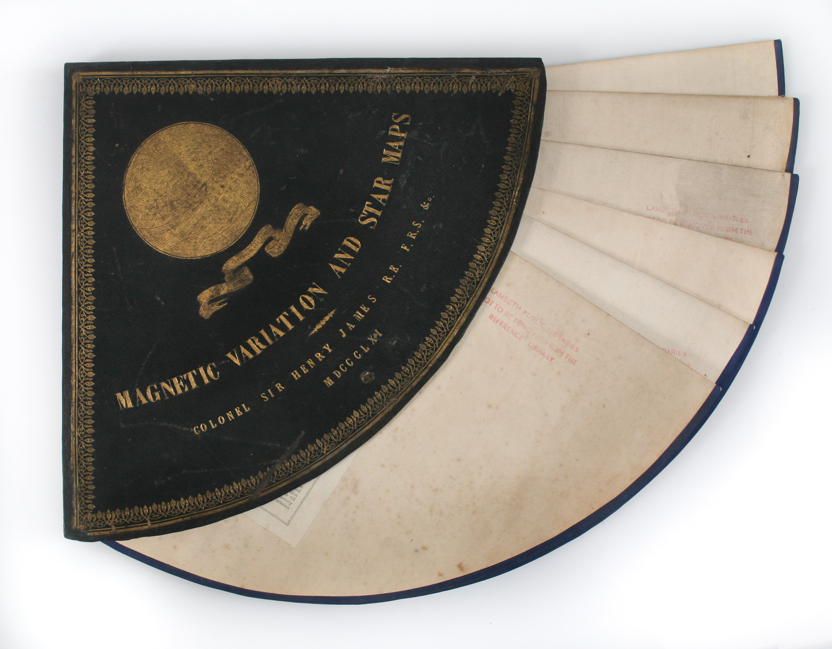
Set of 6 colour chromolithographed circular maps twice folding to fit a custom navy morocco quarter circle slipcase with gilt ornamental borders, titles and pictorial stamped devise, sides and corners restored, this fitting into another stiff cloth coloured solander slipcase with further gilt titles to edge and library shelf markings, maps laid down onto cloth, "The Tate Library, Bixton, S.W." stamps to recto and verso of each sheet, slight soiling at edges and wear at folds, otherwise a very good set. Published by Colonel Sir Henry James, R.E., [London],
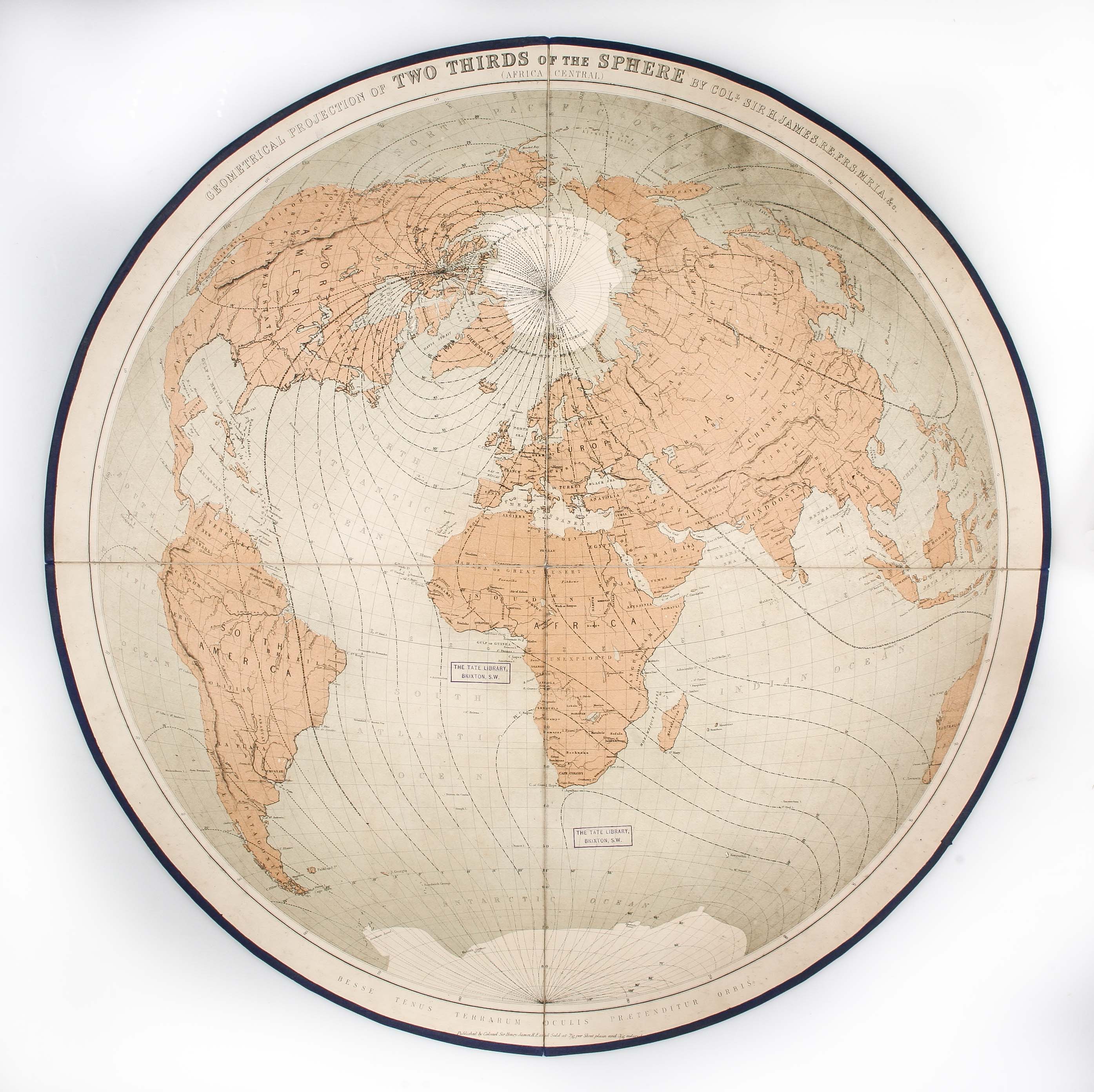
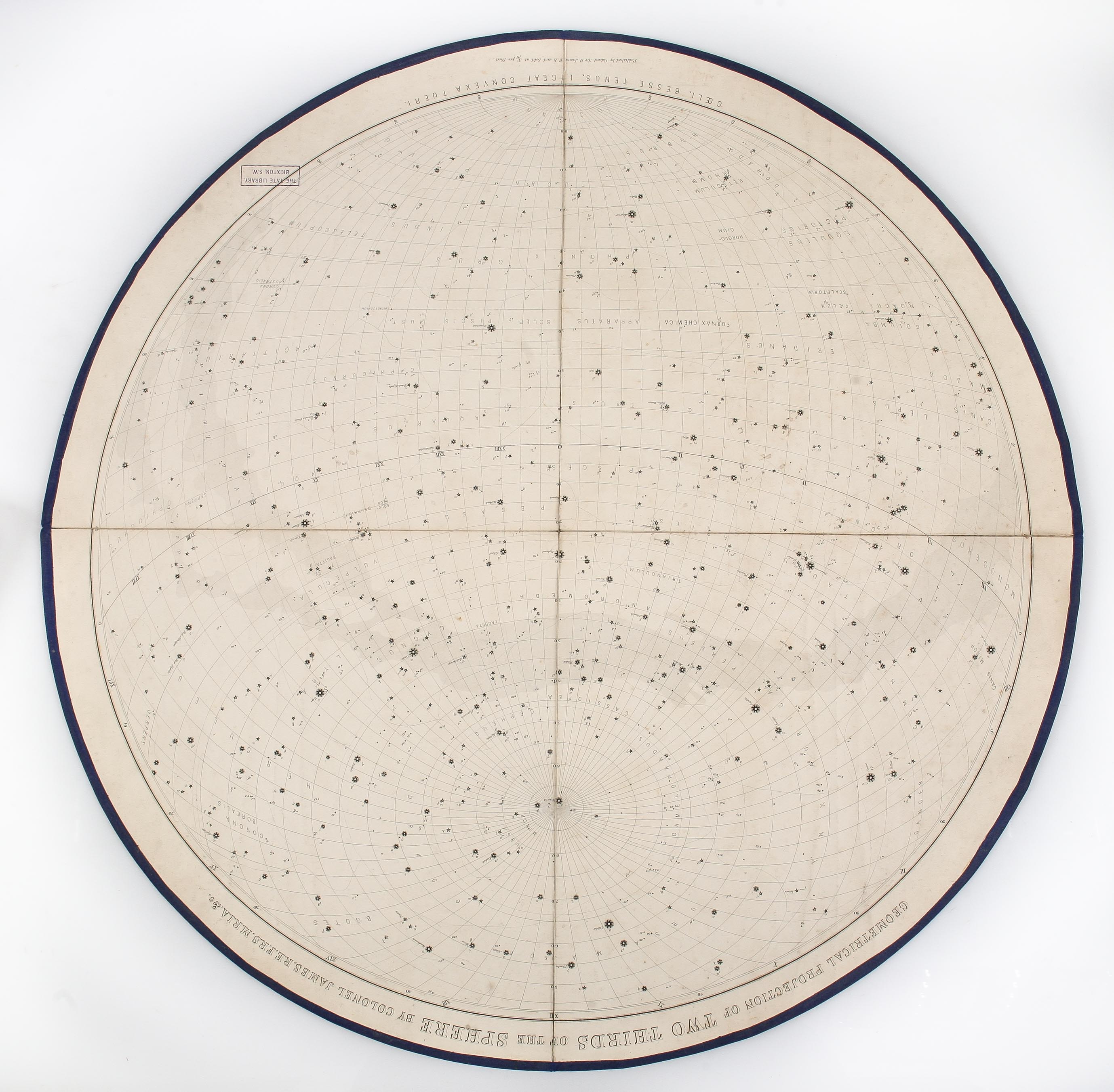
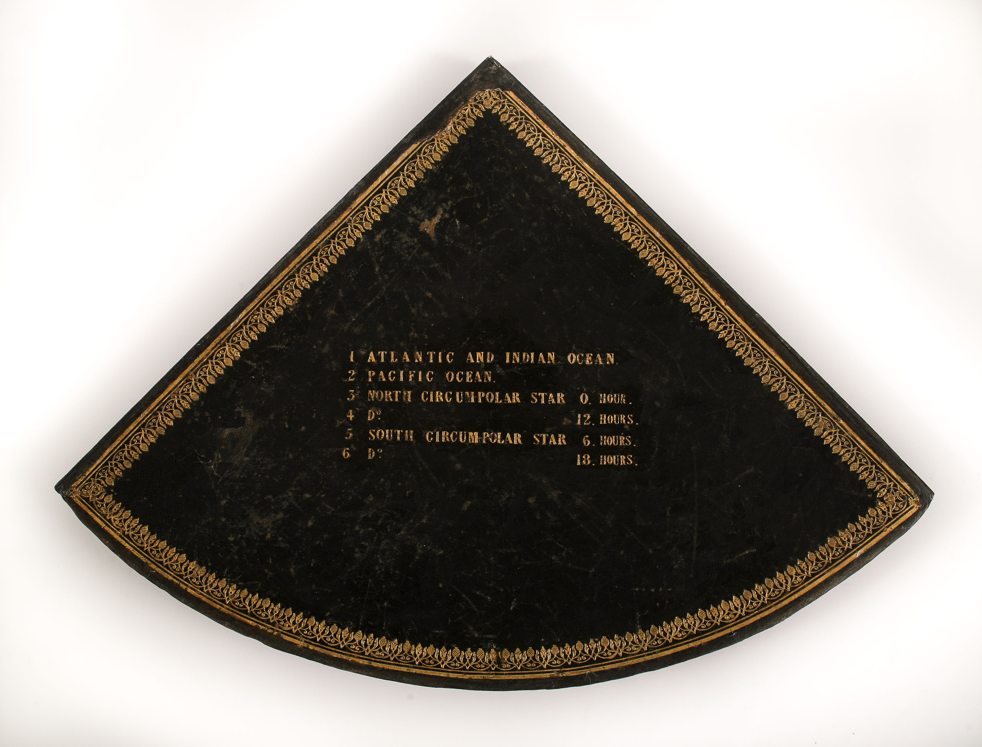
Four celestial and two terrestrial charts, numbered and listed on the slipcase as:
1. Atlantic and Indian Ocean
2. Pacific Ocean
3. North Circumpolar Star 0. Hour.
4. D[itto] 12. Hours.
5. South Circum-Polar Star 6. Hours.
6. D[itto] 18. Hours.
Following an early career as a second lieutenant in the Royal Engineers, Sir Henry James is chiefly remembered for his achievements as a surveyor, heading the Ordnance Survey until his retirement in 1875. He pioneered a new process of map reproduction which he coined 'photozincography', the efficiency and accuracy of which allowed the Ordinance Survey to supply the increasing demand for affordable maps in a variety of scales.
Recently deaccessioned from the Newington Causeway Library in Southwark.
Stock Code: 222605


